The University of Arizona

Blog | CLIMAS

Blog

Southwest Climate Outlook December 2015

El Niño Tracker - Nov 2015

Saturday, November 21, 2015

Originally published as part of the Nov 2015 CLIMAS Southwest Climate Outlook

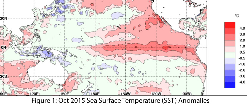
El Niño conditions continued for a ninth straight month, and models continue to forecast a strong El Niño event that likely will last through spring 2016 and remain strong through the early part of the year. Forecasts focused on the persistence of sea-surface temperature (SST) anomalies (Figs.1–2) and weakened trade winds, enhanced convective activity in the central and eastern Pacific, and El Niño-related ocean-atmosphere coupling. (read more)

Image Source - Australian Bureau of Meteorology

Southwest Climate Outlook November 2015 - Climate Summary

Friday, November 20, 2015

Originally published as part of the Nov 2015 CLIMAS Southwest Climate Outlook

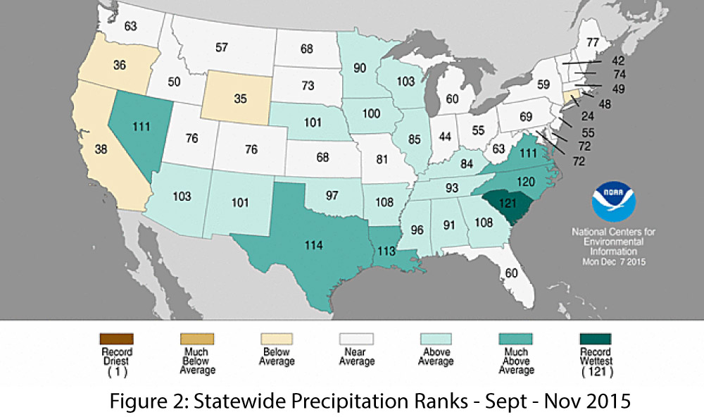
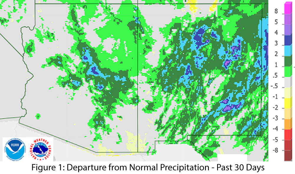
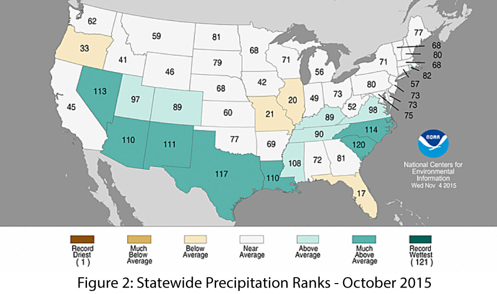
Precipitation: Over the past 30 days, much of Arizona and most of New Mexico recorded above-average precipitation (Fig. 1), as a number of storm systems brought moisture into the region. October rainfall was well above average across most of the southwestern U.S., with top 10 precipitation totals in Texas, New Mexico, and Nevada, and top 15 precipitation totals in Arizona (Fig. 2). November rainfall has been varied, with a mix of above and below-average precipitation.

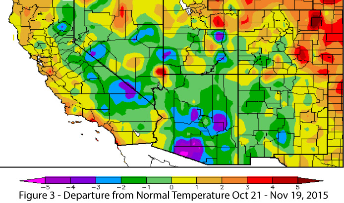
Temperature: November has been cooler than average, particularly in Arizona and most of New Mexico (Fig. 3). These temperatures represent a stark change from October, which was warmer than average in both states. 2015 is set to rival 2014 as the warmest year on record, and we will watch to see whether early November reflects a short-term swing back towards ‘normal’ cooler winter temperatures, or whether the rest of 2015 will warm back up to make a run at the record. (read more)

Bhuwan Thapa - CLIMAS Climate & Society Fellow

Tuesday, November 17, 2015

How farmers are responding to Gorkha Earthquake, climatic and socioeconomic changes in Nepal

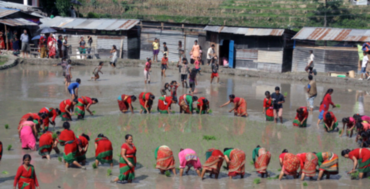
Following the Gorkha earthquake in April 2015, many able farmers in the hard-hit Nuwakot district came together and repaired the damaged irrigational canals. They contributed labor and financial resources and where necessary procured additional funding from government institutions. Though some systems could not be repaired immediately due to lack of human and financial resources, the farmers demonstrated the power of collective action in responding to national disasters.

One of the uniqueness of Nepalese irrigation system is the farmer-managed irrigation system where farmers take the responsibility of the overall irrigation management including operation and maintenance. Indeed during the field trip of summer 2015, I learned that these institutions were pivotal in responding to multiple stresses resulting from natural disasters, climatic and socioeconomic changes. (read more)

Eric Magrane - CLIMAS Climate & Society Fellow

Monday, November 16, 2015

Climate Change and Poetry

At the September 2014 United Nations Climate Summit in New York, Kathy Jetnil-Kijiner, a poet from the Marshall Islands, performed a poem dedicated to her young daughter. The poem speaks of hope for the future in the midst of sea level rise for a homeland—standing just two meters above sea level—that is on the frontlines of climate change: 

no one’s drowning, baby
no one’s moving
no one’s losing
their homeland
no one’s gonna become
a climate change refugee

or should i say
no one else


As both a poet and a geographer, I think a lot about the work that poems like this do. Can poets and artists help us find ways forward in a changing world?

(read more)


Christina Greene - CLIMAS Climate & Society Fellow

Thursday, November 12, 2015

Almonds, Fish, and a Modern Dust Bowl: Narratives of Drought Vulnerability and Adaptation in California's San Joaquin Valley

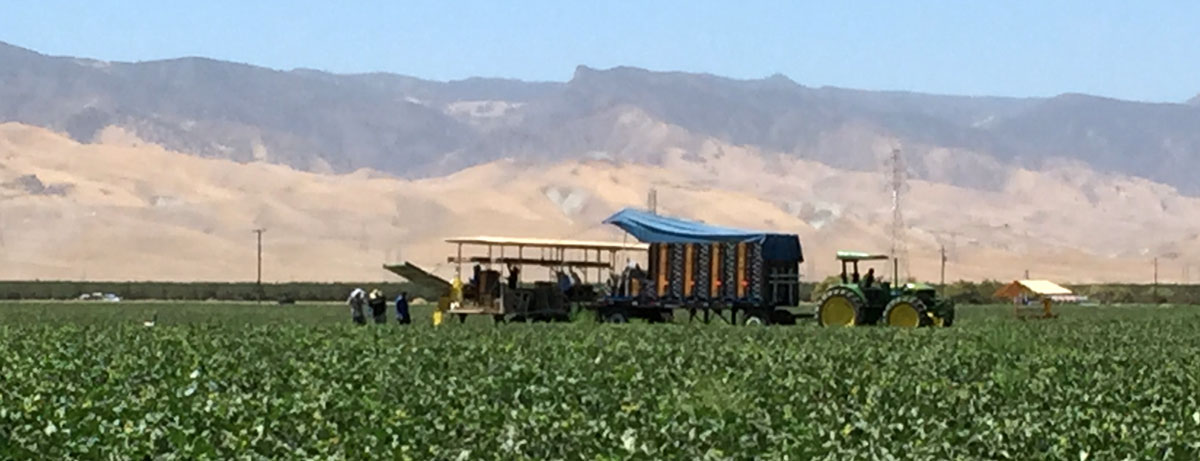
The plums were a deep red, their oozing juices staining the human-sized cardboard box in wine colored hues. Instead of being stacked in neat pyramids or ensconced in plastic, they were piled in by the hundreds, pressing against each other, their bursting flesh perfuming the air. We stood in two single file lines. At the front of the line, volunteers grabbed plums by the handful and thrust them into our outstretched white plastic bags, counting them out “dos, cuatro, ocho, doce, veinte!” I asked the gentleman in front of me in the line “What are plums called in Spanish?” He smiles at me from beneath his cowboy hat, “Ciruela.”

After all the plums have been bagged, we begin the process again with pallets of tomatoes, frozen chickens, rice, beans, and cucumbers. When all the food is packed and sorted into piles, we distribute them to the residents of this small rural city in California’s San Joaquin Valley where everyone’s job depends on agriculture.  Throughout the day I ask people about California’s drought – la sequía. They nod gravely, yes – la sequía.  (read more)

Preparing for High Consequence, Low Probability Events: Heat Water & Energy in the Southwest

Tuesday, November 10, 2015

Residents of the Intermountain Southwest are accustomed to hot temperatures. More than 90 percent of households in Arizona use air conditioning, which accounts for a quarter of the energy consumed in homes: more than four times the national average (U.S. Energy Information Administration).

Now imagine a scenario: It’s June, temperatures are normally over 100 degrees F, but a persistent heat wave causes temperatures to soar over 120 degrees F for several days in a row, with nighttime low temperatures at or near 100°F. Everyone is using their A/C, which overloads the system and results in an extended power outage. Now, not only is it scorching, but without power residents have no way to cool off in their homes. What’s more, the lack of power knocks out the wastewater treatment plant, and now residents lack potable water as well.

You may be thinking that this scenario is highly unlikely, and you’re right. But what if? What if over three million people in the Phoenix metro area lost power during a desiccating pre-monsoon heat wave? Or, what if this situation occurred in Las Vegas, where, in addition to a million residents, there are tourists who are unaccustomed to the heat? How do we plan for something like this? How do we manage the cascade of impacts?

These are the types of questions and scenarios discussed at a workshop, entitled “Preparing for High Consequence, Low Probability Events: Heat, Water & Energy in the Southwest,” held in September in the University of Arizona’s new ENR2 building, in Tucson. (read more)

2015 Monsoon Recap - Oct 2015

Friday, October 16, 2015

Originally published in the October 2015 CLIMAS Southwest Climate Outlook

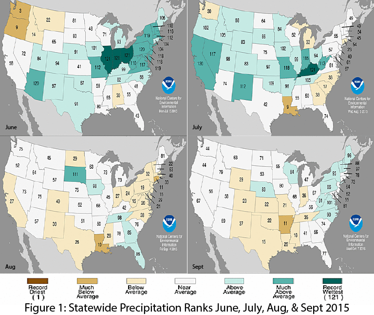
The monsoon started strong in late June and early July. This early start centered on Arizona, which recorded its second wettest June on record (Fig. 1a), with a return to relatively normal rainfall totals in July. New Mexico saw an increase in precipitation, recording its 10th wettest July on record (Fig. 1b). Following a break in the monsoon circulation, rainfall in August and September was average in Arizona and below average for New Mexico (Figs. 1c-1d).  These statewide rankings do little to capture the spatial and temporal variability of the monsoon (see below), but they do give a sense as to the general character of the monsoon.  As noted in the October SW Climate Podcast, the monsoon started strong, but tended to fizzle for most of August and September. However we did see a late season push from tropical storm activity, which helped push some of the monsoon seasonal precipitation totals just above average values. (read more)

Image Source - NOAA - National Centers for Environmental Information

Pages

Subscribe to RSS - blogs