The University of Arizona

Monthly Archive | CLIMAS

Monthly Archive

SW Climate Outlook - Monsoon Case Study - Tucson July 2017

Tuesday, July 25, 2017

The onset of monsoon activity seemed to arrive late in Tucson this year, although residents have been rewarded for their patience by a surge of almost daily storms in the region since July 10. Coincidentally, July 10 was also the third straight day of average daily dewpoint temperatures at or above 54 degrees, thereby meeting the monsoon threshold used by NWS Tucson prior to 2008. The average start date by the former definition is around July 3, although in 2015 and 2016 Tucson met this threshold on June 25. By the dewpoint criteria—and given the absence of any measurable precipitation in Tucson in June and early July, the monsoon did start late, but as was discussed in the most recent episode of the CLIMAS Southwest Climate Podcast, the relatively short length of the monsoon and the desire for relief from the extreme heat of June means any delay to the onset feels like an eternity, even if the first big storm day is only a few days or a week after we might normally expect it. (read more)

SW Climate Outlook - Monsoon Tracker - July 2017

Monday, July 24, 2017

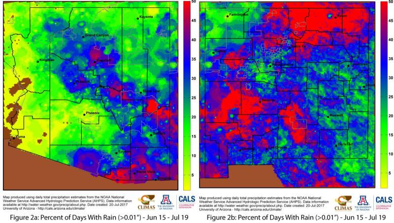
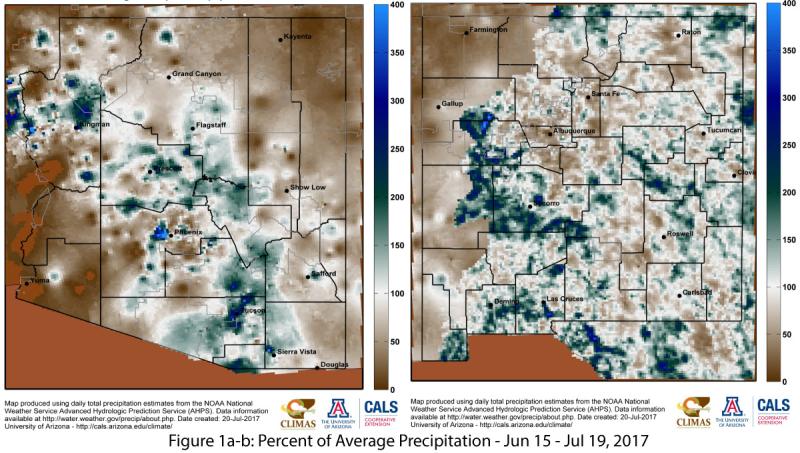
The official start date of the monsoon (June 15) was overshadowed by a Southwest-wide extreme heatwave that set numerous records. Heatwaves in June are a typical feature of the seasonal climate, especially as the subtropical ridge builds north, but these record temperatures also increased the anticipation for the relief that the monsoon can provide. Much of southern and central Arizona have recorded pockets of above-average precipitation, while New Mexico has seen more widely distributed precipitation since June 15 (Fig. 1a-b). (read more)

SW Climate Outlook - ENSO Tracker - July 2017

Friday, July 21, 2017

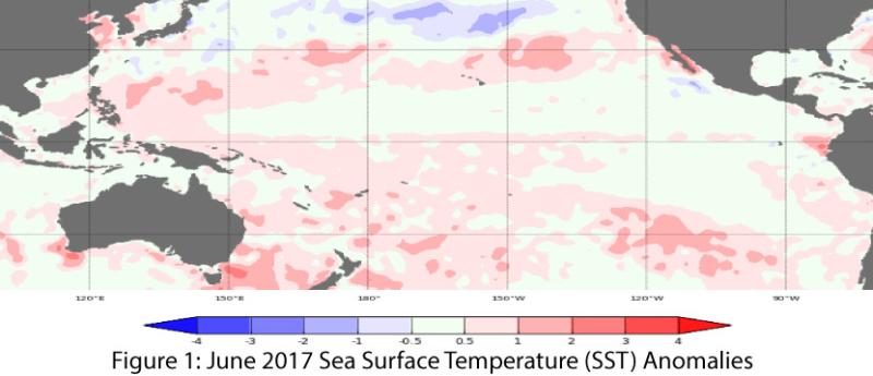
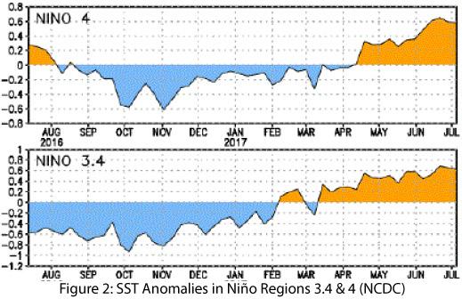
Oceanic and atmospheric indicators are still within the range of neutral (Figs. 1-2), although sea-surface temperatures have hinted at borderline El Niño conditions. Seasonal outlooks and forecasts generally agree that ENSO-neutral conditions are the most likely outcome for the remainder of 2017, albeit with a lingering possibility of an El Niño event by winter 2017-2018. (read more)

SW Climate Outlook July 2017 - Climate Summary

Thursday, July 20, 2017

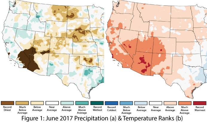
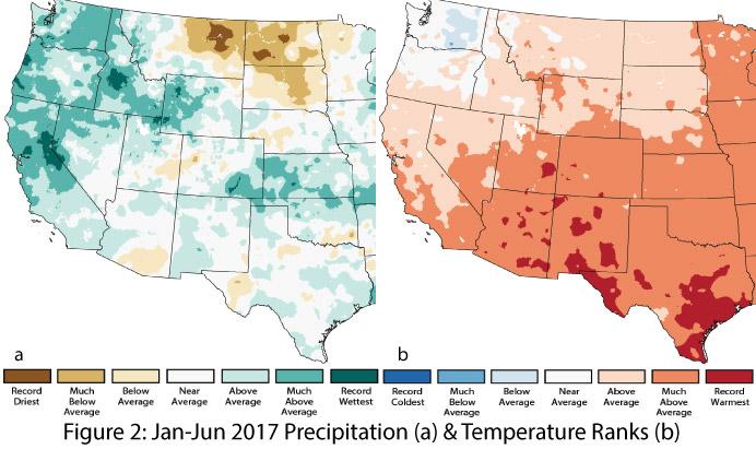
Precipitation and Temperature: June precipitation ranged from record driest to near average in Arizona, while in New Mexico, precipitation ranged from much-below to much-above average (Fig. 1a). This difference reflects the seasonal progression of monsoon activity in the Southwest—it typically starts earlier in New Mexico and progresses westward—as well as the relatively late start to monsoon activity observed in much of Arizona this year. June temperatures ranged from much-above average to record warmest in Arizona and from above average to much-above average in New Mexico (Fig. 1b). A region-wide heat wave that struck in mid-to-late June helped drag up the averages, setting a number of daily high records across Arizona. Year-to-date precipitation ranks reveal average to above-average precipitation in all of New Mexico and much of Arizona, with a pocket of below-average precipitation in southeast Arizona (Fig. 2a). Year-to-date temperatures reveal much-above-average to record-warmest conditions in both Arizona and New Mexico (Fig. 2b).(read more)