The University of Arizona

Monthly Archive | CLIMAS

Monthly Archive

El Niño Tracker - July 2015

Monday, July 20, 2015

El Niño conditions continue for a fifth straight month, and at this point, forecasters are relatively bullish that we are witnessing the development of a moderate-to-strong event that could rival 1997 in absolute magnitude later this year. The most recent outlooks from various sources offer a consistent cluster of forecasts calling for a clear El Niño signal that is maintained or even strengthens well into early 2016. Forecasts focused on the persistence of sea-surface temperature (SST) anomalies (Figs.1 - 2) along with weakening trade winds, ongoing convective activity in the central and eastern Pacific, and El Niño-related ocean-atmosphere coupling. (read more)
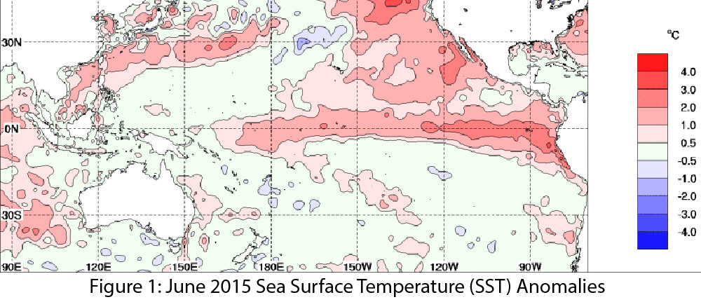
Image Source - Australian Bureau of Meteorology

Monsoon Summary - (June 15 - July 16)

Thursday, July 16, 2015

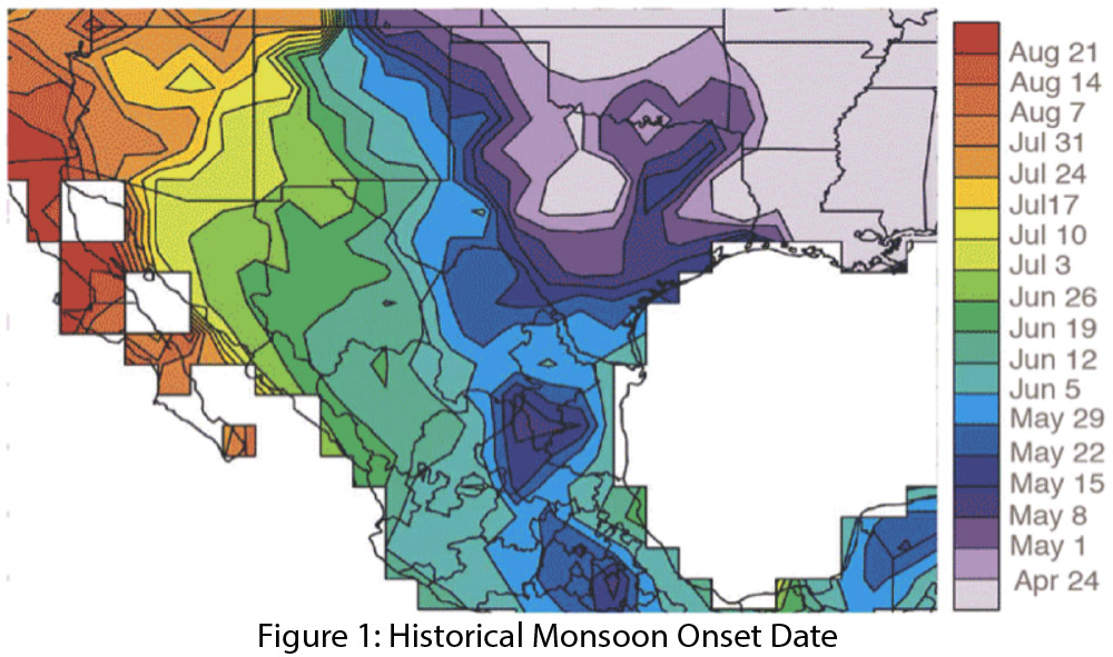
After a few anomalous incursions of tropical moisture in early June, we saw an early beginning to the monsoon in mid- to late June, a few weeks ahead of the typical start date (Fig. 1). Regional dewpoint/humidity readings for June illustrate the multiple incursions of tropical moisture, followed by the onset of monsoon conditions later in the month (Fig. 2). (read more)

June 2015 SW Climate Podcast - Tropical Storms, Monsoon, Wildfire & El Niño

Wednesday, July 1, 2015

In the June 2015 edition of the CLIMAS SW Climate Podcast, Mike Crimmins and Zack Guido recap the month of June, including the quick transition from cool and wet to hot and muggy conditions.  The discuss the impact of tropical storms on the region, the early start to this season, and what this may or may not mean in terms of relationship to monsoon patterns.  They turn to El Niño, and the impact the El Niño signal may be having on the region, both looking back at the past few months, but in particular looking forward at what this could mean for the southwest in terms of precipitation patterns over the next 12 months. (read more)