El Niño Tracker - Dec 2015
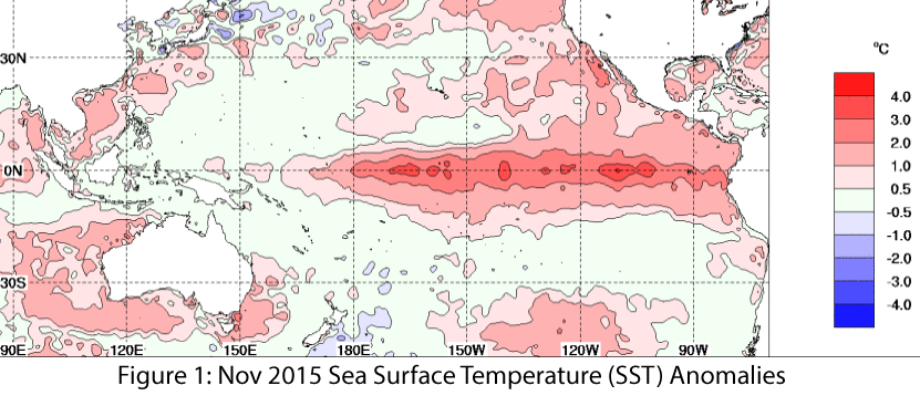
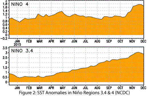
El Niño conditions continued for a 10th straight month, and models continue to forecast a strong El Niño event that will last through spring 2016 and remain strong through the early part of the year. Forecasts focused on the persistence of sea surface temperature (SST) anomalies (Figs. 1–2) and weakened trade winds, enhanced convective activity in the central and eastern Pacific, and El Niño-related ocean-atmosphere coupling. Notably, the SST values in the Niño 3.4 region were at or above the record values in November. Climate scientists have been quick to point out that numerous factors contribute to the overall strength of El Niño, but we are certainly seeing one of the strongest events on record. (read more)
 Image Source - Australian Bureau of Meteorology
 Image Source - NOAA/NWS - Climate Prediction Center


