The University of Arizona

Monthly Archive | CLIMAS

Monthly Archive

SW Climate Outlook - La Niña Tracker - Dec 2017

Friday, December 22, 2017

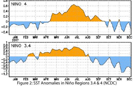
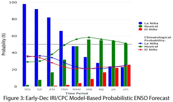
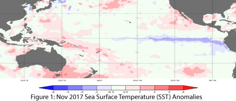
After a relatively late start, La Niña has ramped up over the past 30 days in terms of observed conditions and projected intensity, with sea-surface temperatures (SSTs) demonstrating a more consistent La Niña pattern (Figs. 1-2). Current forecasts and outlooks suggest a weak-to-moderate La Niña event lasting through the winter. (read more)

SW Climate Outlook - La Niña Winter Precip in the SW

Friday, December 22, 2017

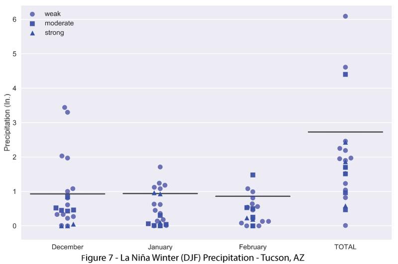
Looking more closely at winter Dec-Feb (DJF) precipitation, most weak La Niña events (ENSO Index Value between -0.5 and -1.0) recorded below-average precipitation, although a few years (1968, 1985) are notable outliers (Figs. 5-6). Looking at the monthly breakdown of weak, moderate, and strong La Niña events reveals that while the DJF totals for Tucson, AZ and Las Cruces, NM are mostly below average (Figs. 7-8), there have been some individual months that recorded precipitation above the monthly average (represented by black lines on the plots). (read more)

SW Climate Outlook Dec 2017 - Climate Summary

Thursday, December 21, 2017

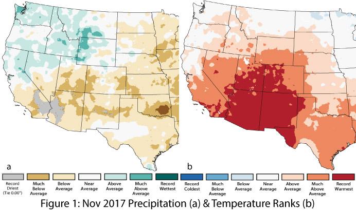
Precipitation & Temperature: November precipitation was below average across most of Arizona, with record-dry conditions in the western third of the state (Fig. 1a). In New Mexico, precipitation was average to much-below average, with small pockets of record-dry conditions in the central part of the state (Fig. 1a). November temperatures broke record highs across nearly all of Arizona and New Mexico (Fig. 1b). (read more)