June 2018 SW Climate Outlook - Monsoon Tracker & Tropical Storm Bud
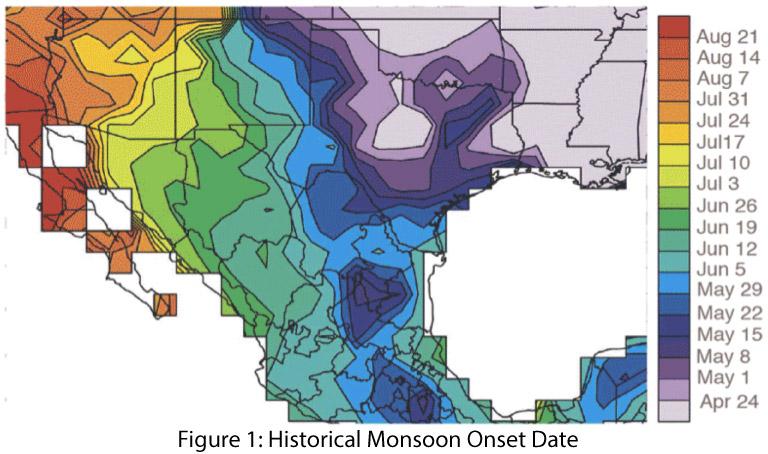
Was our mid-June precipitation the monsoon? In 2008, the National Weather Service (NWS) changed the definition of the start of the Southwest monsoon from a variable date based on locally measured conditions to a fixed date of June 15 (and a fixed end date of Sept 30). This allowed for a clear delineation of the period of monsoon activity (108 days) and focused NWS’s messaging strategy as it pertains to the expected hazards during that period, which include extreme heat, strong winds, dust storms, flash flooding, lightning, and wildfires (see NWS Tucson monsoon information hub). Prior to 2008, the flexible start date reflected the seasonal progression of the monsoon, with a considerable temporal gradient across the region (Fig. 1). (read more)

