The University of Arizona

Monthly Archive | CLIMAS

Monthly Archive

2015 Monsoon Recap - Oct 2015

Friday, October 16, 2015

Originally published in the October 2015 CLIMAS Southwest Climate Outlook

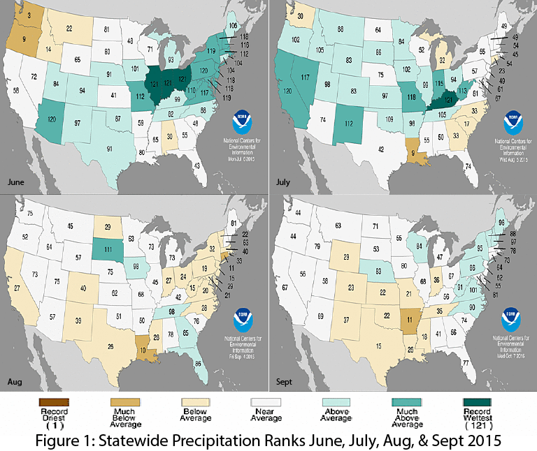
The monsoon started strong in late June and early July. This early start centered on Arizona, which recorded its second wettest June on record (Fig. 1a), with a return to relatively normal rainfall totals in July. New Mexico saw an increase in precipitation, recording its 10th wettest July on record (Fig. 1b). Following a break in the monsoon circulation, rainfall in August and September was average in Arizona and below average for New Mexico (Figs. 1c-1d).  These statewide rankings do little to capture the spatial and temporal variability of the monsoon (see below), but they do give a sense as to the general character of the monsoon.  As noted in the October SW Climate Podcast, the monsoon started strong, but tended to fizzle for most of August and September. However we did see a late season push from tropical storm activity, which helped push some of the monsoon seasonal precipitation totals just above average values. (read more)

Image Source - NOAA - National Centers for Environmental Information

El Niño Tracker - Oct 2015

Thursday, October 15, 2015

Originally published in the Oct 2015 CLIMAS Southwest Climate Outlook

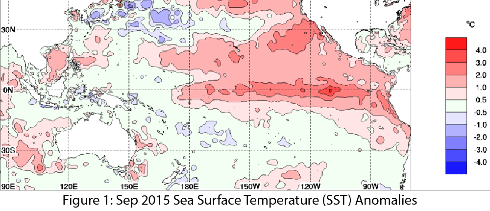
We spent the better part of 2014 (and the first part of 2015) waiting in anticipation for an El Niño event that was initially forecast to be one of the stronger events on record. By early 2015, the event in question had not yet materialized, and some questioned whether El Niño would ever arrive. Eventually it did, and has been going strong for months, with most forecasts indicating that it will remain a strong event through the winter. (read more)

Image Source - Australian Bureau of Meteorology