The University of Arizona

Blog | CLIMAS

Blog

El Niño Tracker - Oct 2015

Thursday, October 15, 2015

Originally published in the Oct 2015 CLIMAS Southwest Climate Outlook

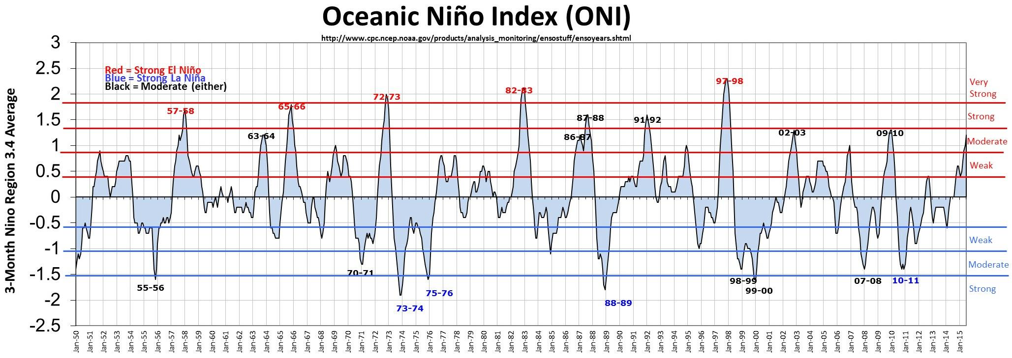
We spent the better part of 2014 (and the first part of 2015) waiting in anticipation for an El Niño event that was initially forecast to be one of the stronger events on record. By early 2015, the event in question had not yet materialized, and some questioned whether El Niño would ever arrive. Eventually it did, and has been going strong for months, with most forecasts indicating that it will remain a strong event through the winter. (read more)
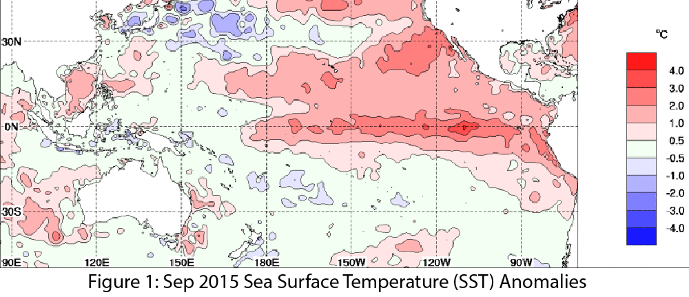
Image Source - Australian Bureau of Meteorology

El Niño is here…what exactly does that mean for Arizona and New Mexico?

Thursday, September 24, 2015

“El Niño” has been all over the news lately, even garnering comparisons to a Godzilla – a prehistoric sea monster awakened and empowered by nuclear radiation (thank you Wikipedia). This characterization is in response to the near record strength of this El Niño event, which is exciting for climate enthusiasts, but leaves most people wondering; what does a strong El Niño event actually mean for Arizona and New Mexico? Are we talking floods? Droughts?  Plagues of locusts? Additionally, how soon can we expect this “El Niño” character to show up?  In other words, what does a realistic assessment look like? (read more)

Monsoon Summary Jun 15-Sep 17

Saturday, September 19, 2015

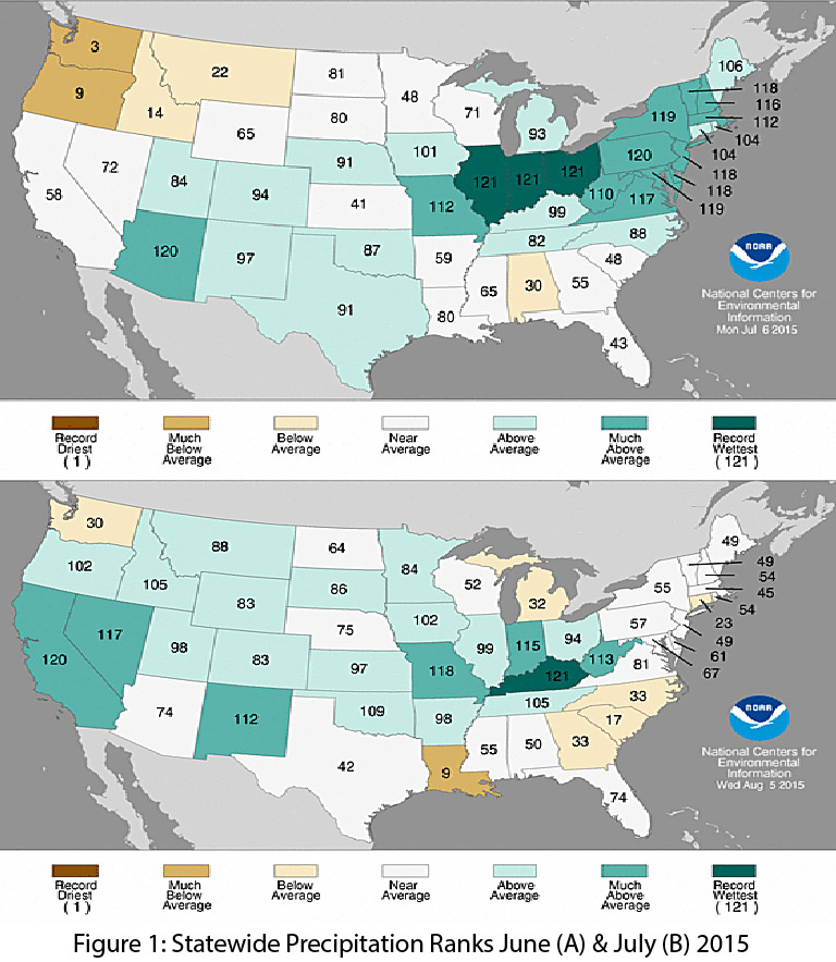
The monsoon started strong in late June and early July. This early start centered on Arizona, which recorded its second wettest June on record (Fig. 1a), with a return to relatively normal rainfall totals in July. New Mexico saw an increase in precipitation, recording its 10th wettest July on record (Fig. 1b). Rainfall in August and September was mostly below average, which is characteristic of the North American monsoon’s sporadic and spatially limited precipitation events. (read more)

El Niño Tracker - September 2015

Friday, September 18, 2015

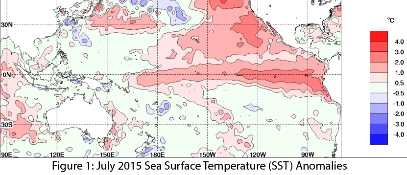
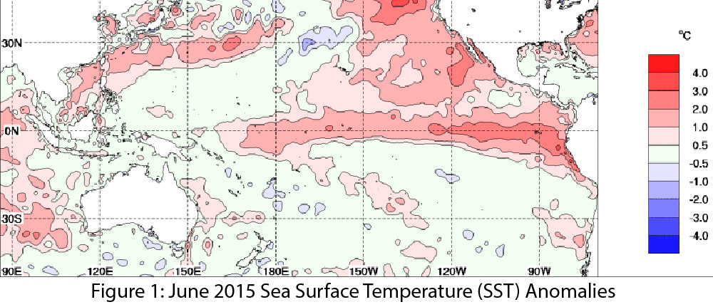
El Niño conditions continued for a seventh straight month, and forecasts and models indicate this event likely will last through spring 2016, remaining strong through the early part of the year. Forecasts focused on the persistence of sea-surface temperature (SST) anomalies (Figs.1–2) and weakened trade winds, ongoing convective activity in the central and eastern Pacific, and El Niño-related ocean-atmosphere coupling. (read more)

Monsoon Summary Jun 15-Aug 20

Friday, August 21, 2015

Originally published in the August 2015 CLIMAS Southwest Climate Outlook

The monsoon started off early and strong with several widespread thunderstorms in late June and early July, especially in Arizona, which recorded its second wettest June on record.  Precipitation tapered to some extent in July in Arizona but continued to be frequent and widespread in New Mexico, which recorded its 10th wettest July on record (Figs. 1a-2a). (read more)

El Niño Tracker - August 2015

Friday, August 21, 2015

Originally published in the August 2015 CLIMAS Southwest Climate Outlook

El Niño conditions continued for a sixth straight month and forecasts and the most recent outlooks offer a consistent cluster of forecasts calling for a clear El Niño signal similar to past strong events, lasting into early 2016. Forecasts focused on the persistence of sea-surface temperature (SST) anomalies (Figs.1–2) and on weakened trade winds, ongoing convective activity in the central and eastern Pacific, and El Niño-related ocean-atmosphere coupling. (read more)

Image Source - Australian Bureau of Meteorology

El Niño Tracker - July 2015

Monday, July 20, 2015

El Niño conditions continue for a fifth straight month, and at this point, forecasters are relatively bullish that we are witnessing the development of a moderate-to-strong event that could rival 1997 in absolute magnitude later this year. The most recent outlooks from various sources offer a consistent cluster of forecasts calling for a clear El Niño signal that is maintained or even strengthens well into early 2016. Forecasts focused on the persistence of sea-surface temperature (SST) anomalies (Figs.1 - 2) along with weakening trade winds, ongoing convective activity in the central and eastern Pacific, and El Niño-related ocean-atmosphere coupling. (read more)

Image Source - Australian Bureau of Meteorology
Monsoon Summary - (June 15 - July 16)

Thursday, July 16, 2015

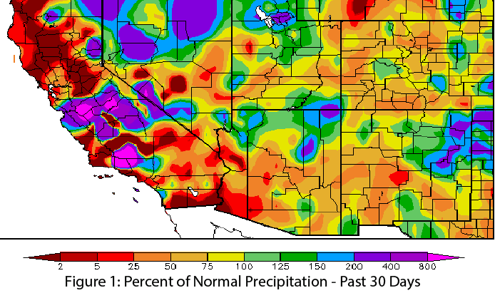
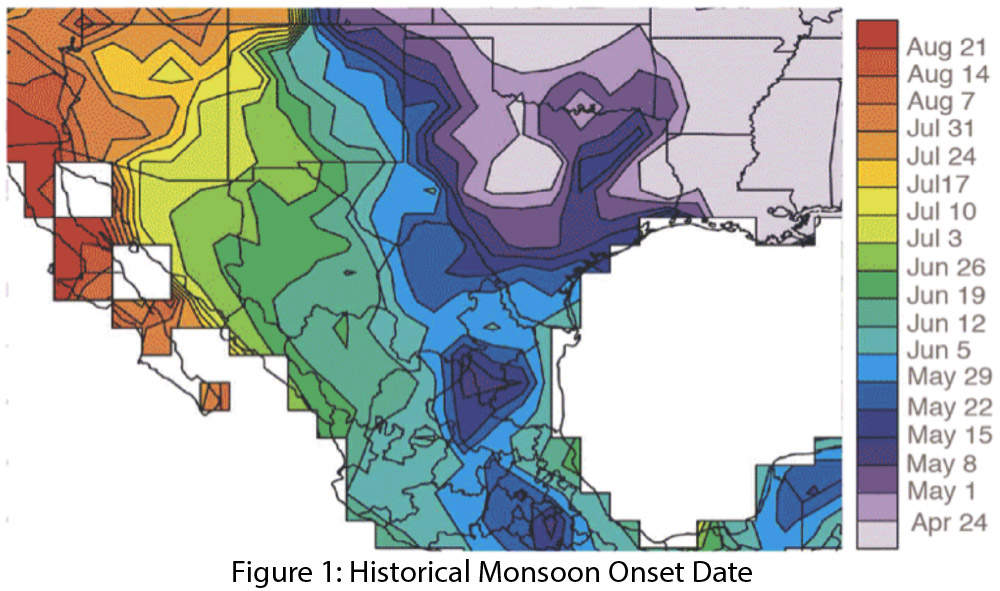
After a few anomalous incursions of tropical moisture in early June, we saw an early beginning to the monsoon in mid- to late June, a few weeks ahead of the typical start date (Fig. 1). Regional dewpoint/humidity readings for June illustrate the multiple incursions of tropical moisture, followed by the onset of monsoon conditions later in the month (Fig. 2). (read more)

Pages

Subscribe to RSS - blogs