SW Climate Outlook Nov 2017 - Climate Summary
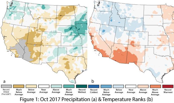
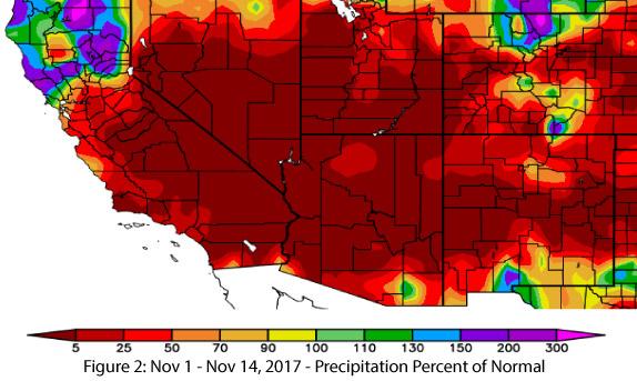
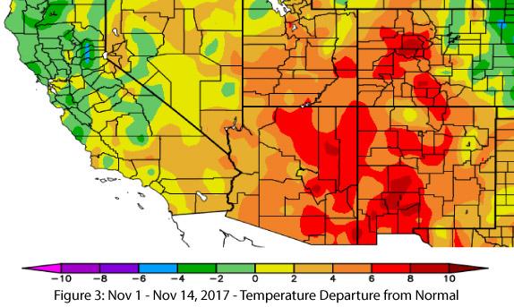
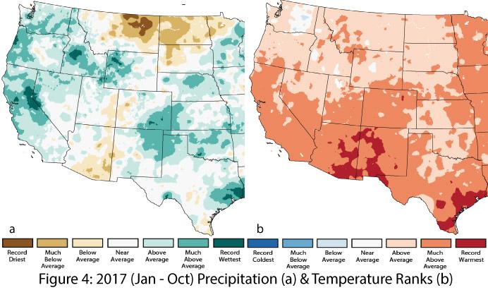
Precipitation & Temperature: October precipitation was below average to record driest in Arizona, with the driest conditions occurring in the southwestern corner of the state (Fig. 1a). In New Mexico, precipitation was average to above average in the eastern half of the state, and average to below average in the western half (Fig 1a). October temperatures were above average to much-above average across both Arizona and New Mexico (Fig. 1b) except for small regions in the north and in eastern New Mexico. Thus far, November has been mostly dry in the Southwest (Fig. 2), while temperatures have mostly been above average (Fig. 3). Year-to-date precipitation ranges widely from much-below average in southeastern Arizona to much-above average in northeastern New Mexico (Fig. 4a). Year-to-date temperatures have been consistently warmer than average, with nearly all of Arizona and New Mexico recording much-above average temperatures, including pockets of record-warmest conditions in both states (Fig. 4b).
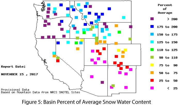
Snowpack & Water Supply: Snow water equivalent (SWE) is mostly below average across the Southwest, whereas the opposite has occurred in the Pacific Northwest (Fig. 5). Our dry conditions are partially attributable to persistent warm temperatures and relatively dry conditions in October and November. With the emergent weak La Niña event – and its associated warmer and drier conditions in the Southwest – the potential implications for drought and water resource management are something to watch over the winter season.
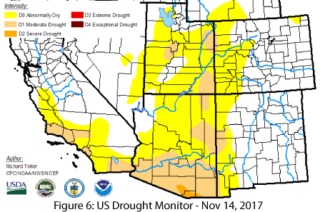
Drought: The trend of relatively widespread drought conditions in most of Arizona and western New Mexico continued this past month. The southern third of Arizona is mostly classified as D1 (moderate drought) with a small pocket of D2 (severe drought), while the northern two-thirds is mostly classified as D0 (abnormally dry) with pockets of D1. New Mexico is free of drought designation except for the western edge, which is classified as a mix of D0 and D1 (Fig. 6).
ENSO & La Niña: October saw the onset of a La Niña event that is expected to continue through at least winter 2018. However, the current forecast also suggests this will remain a weak La Niña event, for which correlations to below-average winter precipitation in the Southwest are not as evident (see La Niña Tracker on p. 3-4 for more details).
Tropical Storms: The 2017 eastern Pacific tropical storm season is winding down, and as of Nov. 16, 2017, there have been 18 named storms, including nine hurricanes and four major hurricanes – totals that fell within the expected range of the May 25 NOAA seasonal forecast for 14-20 named storms, including 6-11 hurricanes and 3-7 major hurricanes. Notably, while the eastern Pacific basin was active, very little of the mid-to-late season activity (September-October) reached the Southwest this year. In a typical year, the Southwest often sees a few mid-to-late season tropical storms curve back into the region. Those that arrive prior to Sept. 30 can help boost monsoon seasonal totals, while those that arrive after Oct. 1 can jumpstart water-year precipitation.
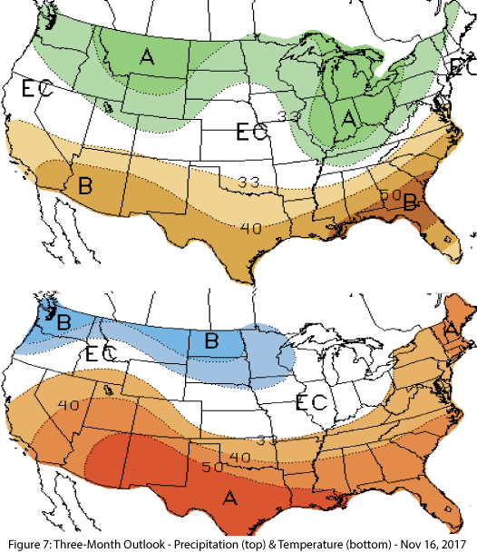
Precipitation & Temperature Forecast: The three-month outlook for December through February calls for increased chances of below-average precipitation for nearly all of Arizona and New Mexico (Fig. 7, top), and increased chances of above-normal temperatures for the entire southwestern United States (Fig. 7, bottom).

