SW Climate Outlook Dec 2017 - Climate Summary
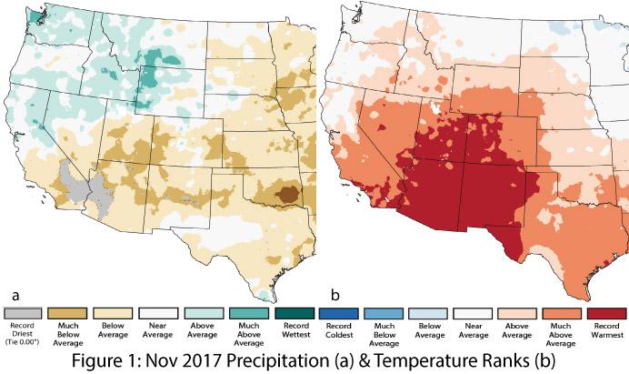
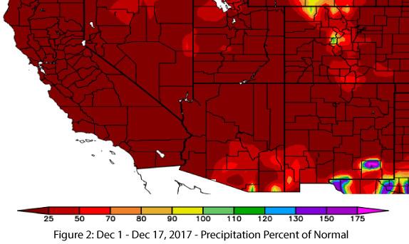
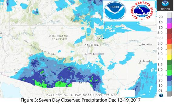
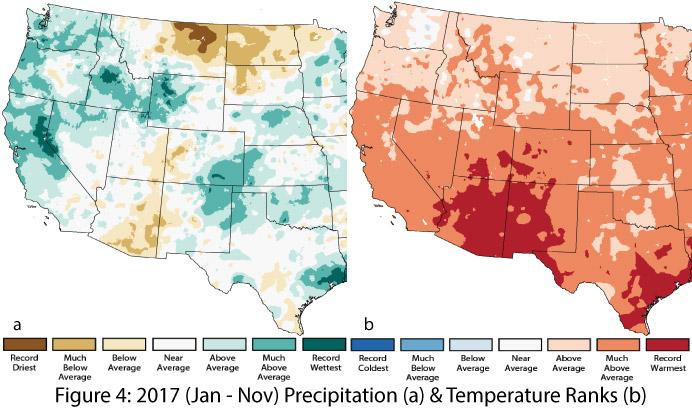
Precipitation & Temperature: November precipitation was below average across most of Arizona, with record-dry conditions in the western third of the state (Fig. 1a). In New Mexico, precipitation was average to much-below average, with small pockets of record-dry conditions in the central part of the state (Fig. 1a). November temperatures broke record highs across nearly all of Arizona and New Mexico (Fig. 1b). Thus far, December has continued the trend of above-average to near-record temperatures and very dry conditions (Fig. 2), although at the time of this writing (Dec. 20), a series of storms had brought welcome precipitation to the Southwest (Fig. 3). Year-to-date precipitation ranges widely from much-below average in southeastern Arizona to much-above average in northeastern New Mexico (Fig. 4a). Year-to-date temperatures have been consistently warmer than average, with most of Arizona and New Mexico recording either much-above average or record-warmest conditions (Fig. 4b).
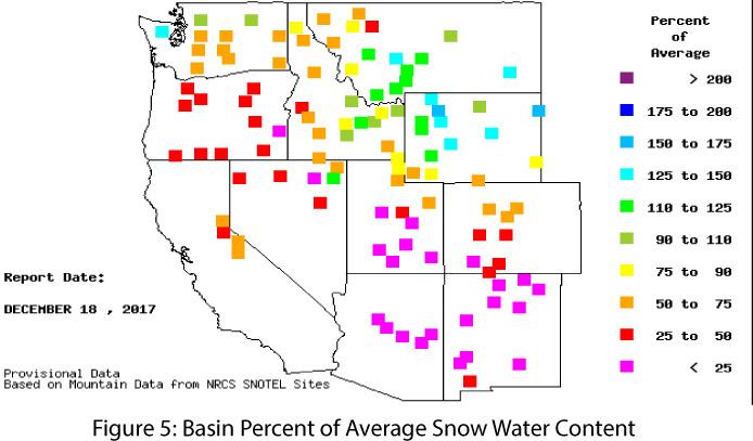
Snowpack & Water Supply: Snowpack and snow water equivalent (SWE) are below average across the Southwest, California, and the Pacific Northwest, with a mix of above- and below-average conditions in the Intermountain West (Fig. 5). Most of the Southwest has experienced above-average temperatures and below-average precipitation for much of the fall season (Sept-Oct-Nov), which is a primary factor in the below-average snowpack and concerns about water supply for 2017-2018. The ongoing La Niña event – and its associated warmer and drier conditions in the Southwest – has potential implications for drought and water resource management over the winter season (see Arizona and New Mexico reservoir volumes).
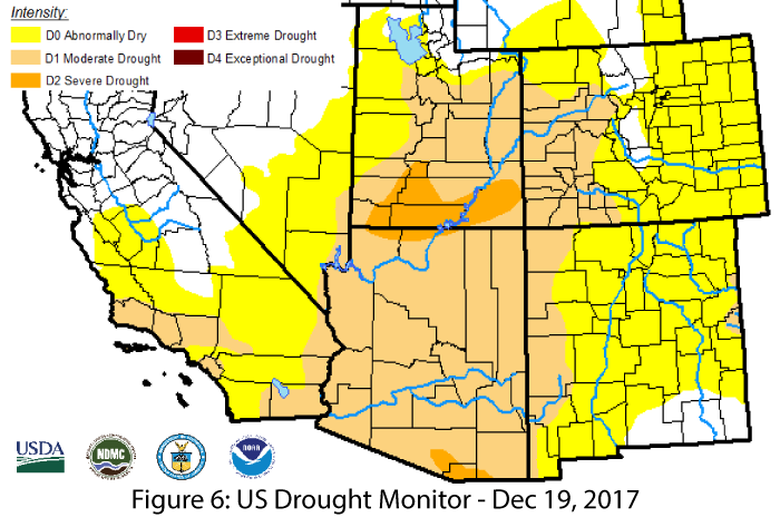
Drought: Above-average temperatures and below-normal precipitation are reflected in the expanding areas of drought designation, with both Arizona and New Mexico seeing increases in extent and intensity of drought. On the Dec. 19 U.S. Drought Monitor (Fig. 6), nearly all of Arizona is classified as moderate drought (D1), with a pocket of severe drought (D2) on the U.S.-Mexico border. New Mexico has likewise seen a widespread expansion of drought conditions, with most of the state now classified as abnormally dry (D0) and intensifying to moderate drought (D1) along the western edge. These classifications are primarily the result of below-average precipitation across much of the region over the last few months, but also include the effect of long-term persistent drought.
ENSO & La Niña: After a relatively late start, La Niña has ramped up in terms of observed conditions and projected intensity, and current forecasts suggest a weak-to-moderate La Niña event lasting through winter 2018. Weak La Niña events tend to produce drier-than-average winters, but moderate events have resulted in more consistently dry conditions over the winter season (see La Niña Tracker and DJF La Niña Precip in the SW for details), Thus, this projected increase in strength is worth watching over the next few months to see how the Southwest fares in terms of winter precipitation, drought, and water resource management.
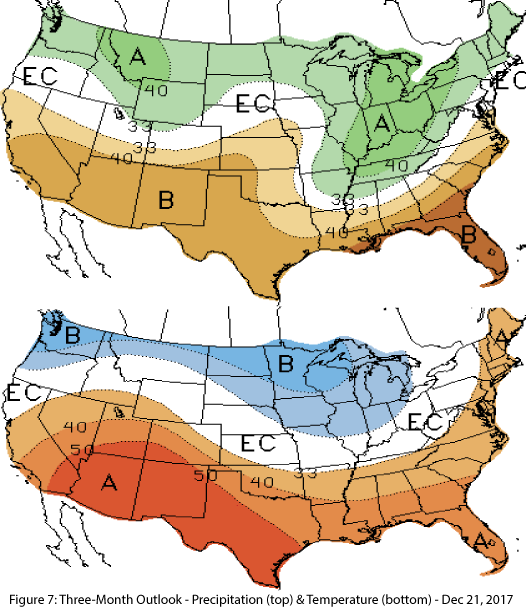
Precipitation & Temperature Forecast: The three-month outlook for January through March calls for increased chances of below-average precipitation for all of Arizona and New Mexico (Fig. 7, top), and increased chances of above-average temperatures for the entire southwestern United States (Fig. 7, bottom).
Online Resources / Image Credits
- Figures 1,4 - National Center for Environmental Information - www.ncdc.noaa.gov
- Figures 2-3 - High Plains Regional Climate Center - www.hprcc.unl.edu
- Figure 5 - Western Regional Climate Center - www.wrcc.dri.edu
- Figure 6 - U.S. Drought Monitor - www.droughtmonitor.unl.edu/
- Figure 7 - NOAA - Climate Prediction Center - www.cpc.ncep.noaa.gov/

