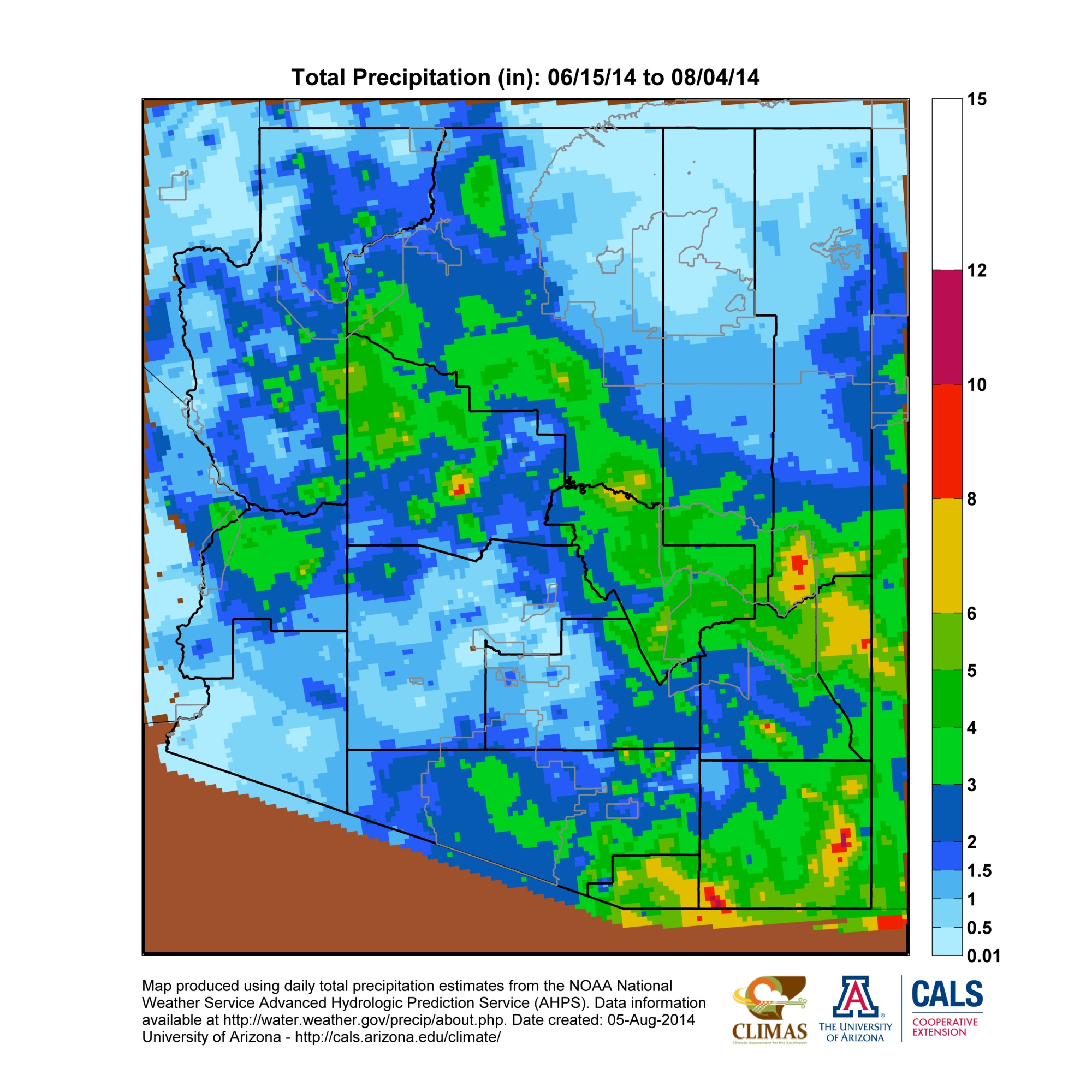
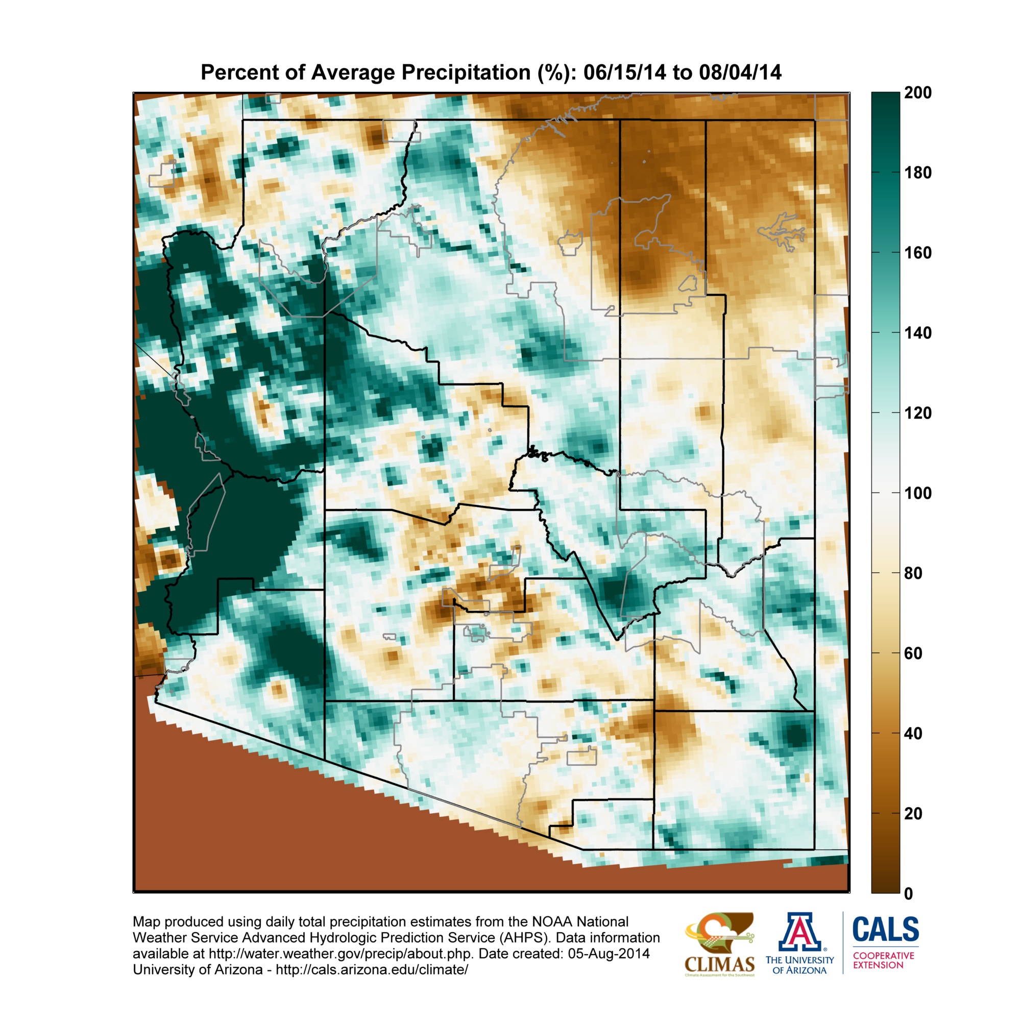
Notes from an Applied Climatologist - July 2014 Rainlog Climate Summary
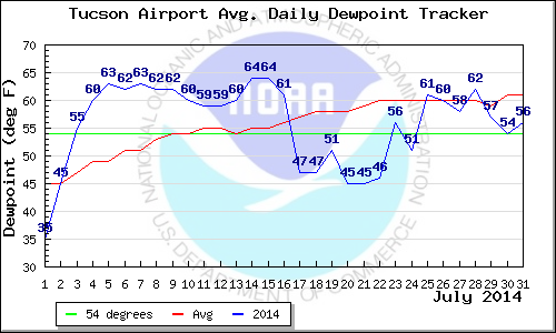 July started off with a bang with moisture and thunderstorm activity moving into Arizona over the 4th of July weekend. This start date for monsoon thunderstorm activity was very close to the climatological start date of July 3rd, as determined by the old dewpoint definition (three consecutive days with average dewpoints >= 54F) in Tucson. The ‘monsoon ridge’ of high pressure was in an ideal position over the first two weeks of July to guide abundant subtropical moisture into the state, providing fuel for almost daily thunderstorm activity across parts of southeastern Arizona and the high country along the Mogollon Rim.
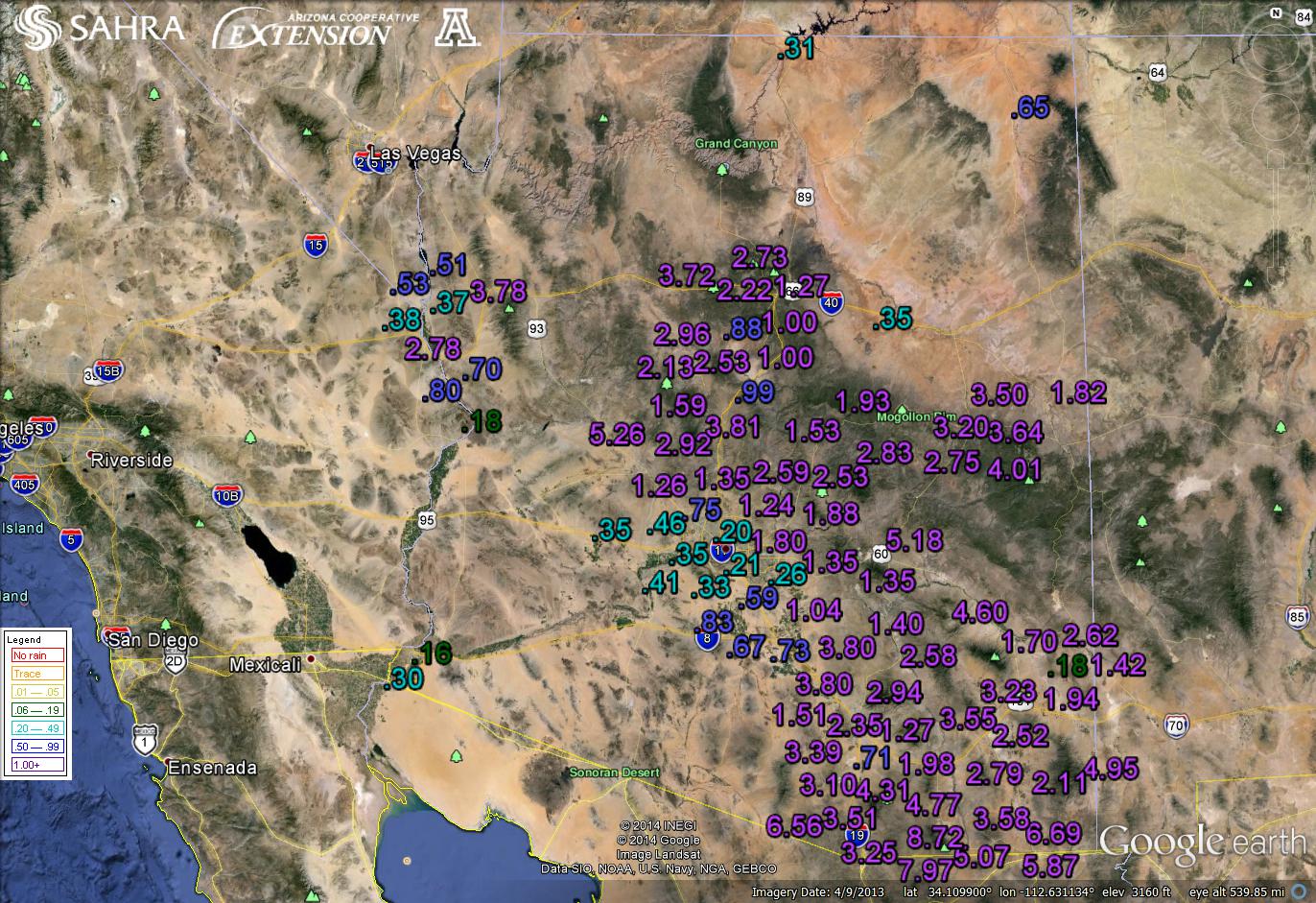
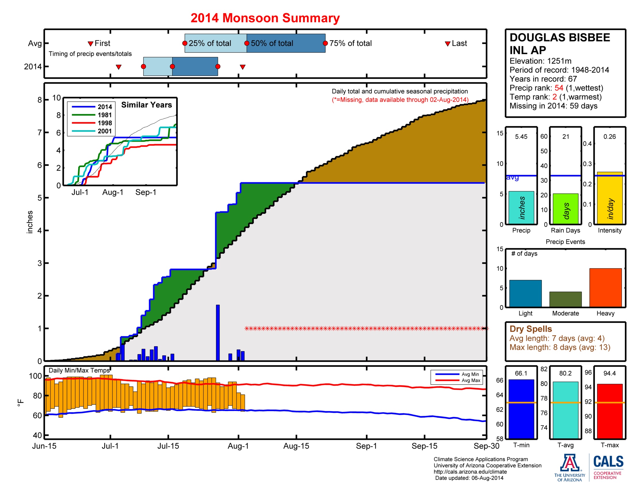
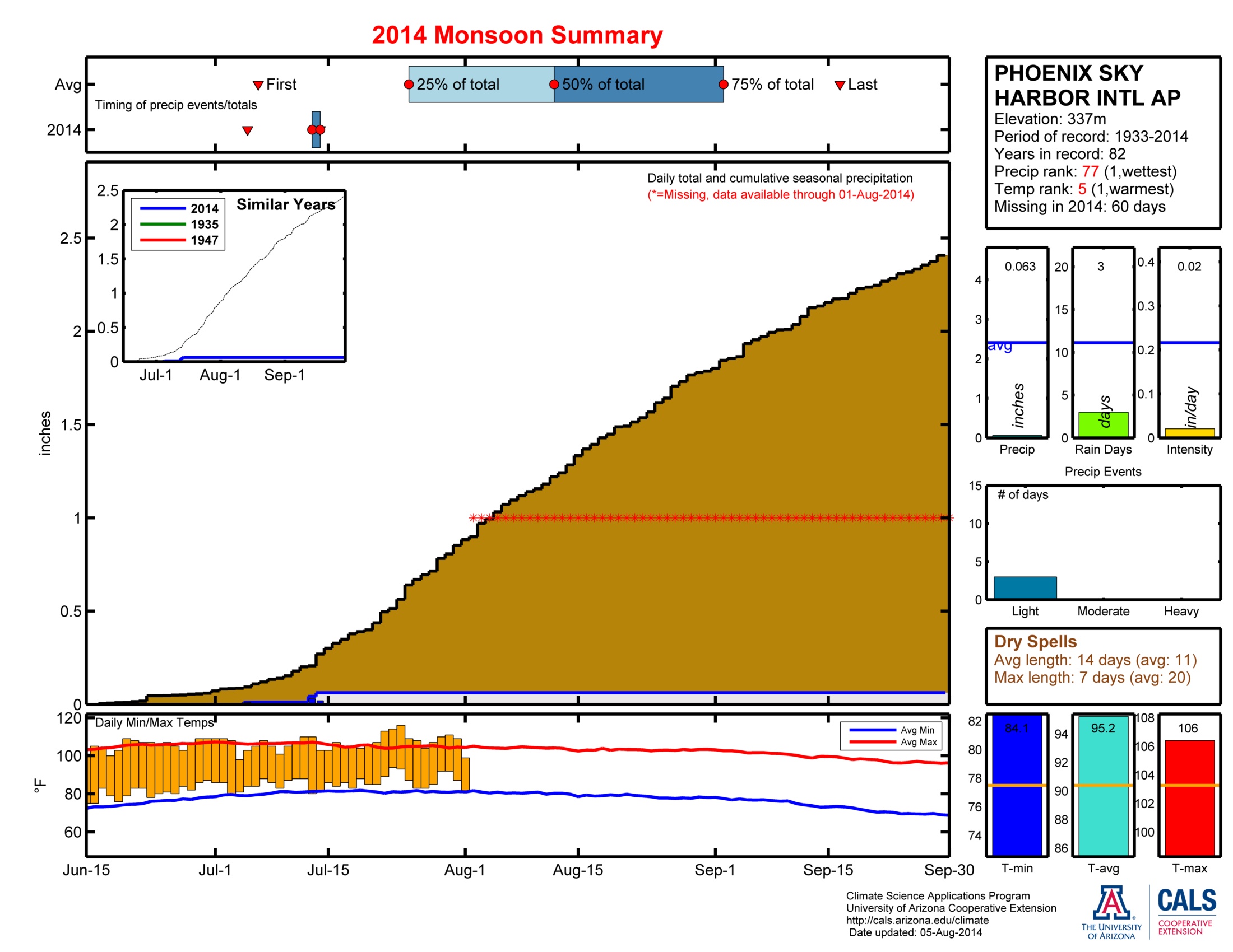
Rainloggers in southern Arizona near Sierra Vista observed amazing precipitation totals of 5 to 7 inches over the first two weeks of the month. Most other areas observed 1-3 inches during this period with higher elevation areas near Show Low and Flagstaff seeing closer to 2 to 4 inches. Most of the Phoenix metro area saw more dust than rain during this period with thunderstorm outflows pushing large haboobs or dust storms through the area numerous times.
 Monsoon Tracker Plots - Find More Here
The monsoon ridge was knocked out of position several times the second half of the month leading to a slowdown in monsoon thunderstorms across much of the state. Parts of southeastern Arizona still managed to pick up several inches of precipitation in a handful of storm events. Several Rainloggers near Douglas observed almost two inches of rain on the 27th with a series of storms that moved along the international border. The Tucson and Phoenix metro areas observed isolated storms during this period with lucky neighborhoods seeing up to an inch of rain, but most observing less than 0.25”.
Overall, July was a pretty typical start to the monsoon with some areas observing very heavy rain and many places with a handful of light events. Most of the state is near average for monthly total precipitation with the notable exception of far northeast Arizona which has observed very little in the way of thunderstorm activity. Temperatures were above average across much of the state with the National Weather Service in Tucson reporting that it was the 13th warmest July on record. Overnight temperatures were the big story this past month with Tucson and Phoenix observing several new high minimum temperatures records or ties. The National Weather Service reports that it was the 3rd warmest for Tucson and 5th warmest for Phoenix on record with respect to July minimum temperatures.
Michael Crimmins is an Associate Professor and Climate Science Extension Specialist in the Department of Soil, Water and Environmental Science

