Notes from an Applied Climatologist - Aug 2014 Rainlog Climate Summary
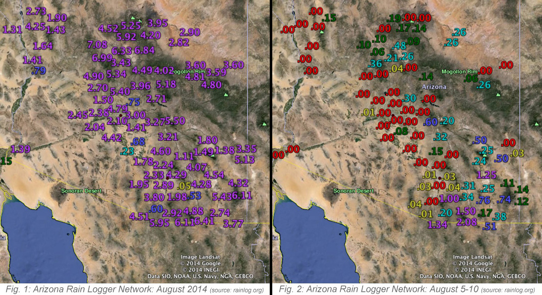
The monsoon season continued to roll along throughout August, bringing abundant precipitation to much of Arizona, yet some places were still between the rain drops, as is typical with summer thunderstorms in the southwest. The month started off strong, with the monsoon ridge pushing to the north over the first couple of days of the month. This helped to usher in low-level moisture, and fueling scattered thunderstorms across the state.
This didn’t last long, and by end end of the first week of August, a low pressure trough off the coast of California weakened the ridge and shifted it to the east. This pushed the low-level moisture south, and caused a brief dry out across much of Arizona. During this mini-break, we saw limited thunderstorm activity in the higher elevation areas of the southeast corner of Arizona between Aug 5th and Aug 10th.

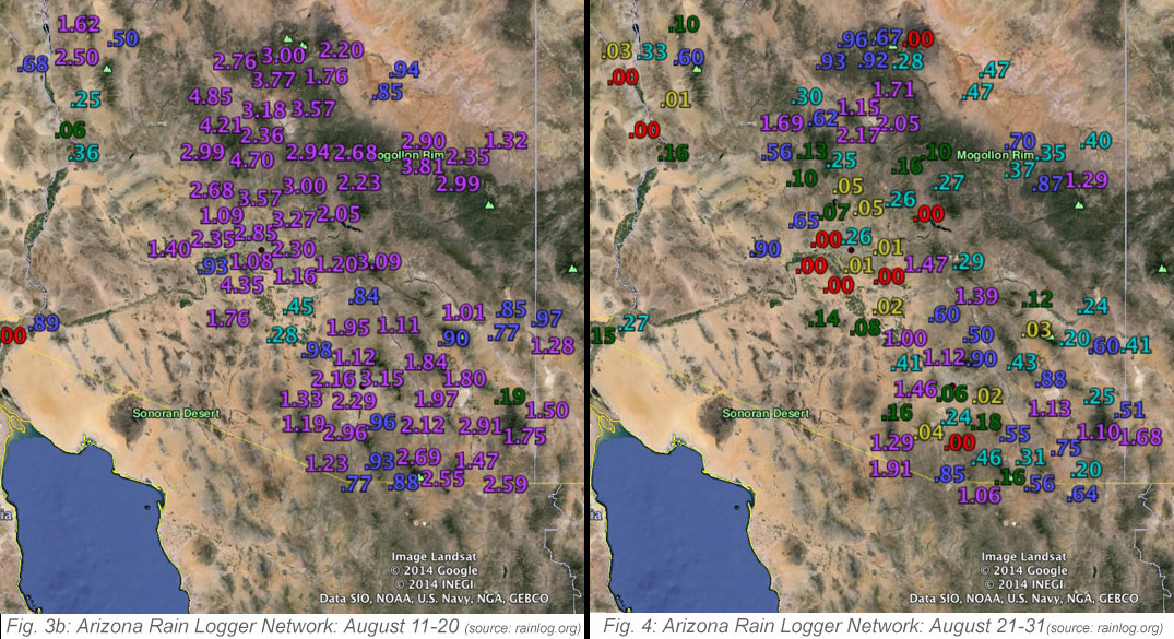
Beginning on the 11th, the monsoon ridge pushed north again, helping to restart the deep southerly flow of moisture into the Southwest. August 12th was a (very) big day for rainfall, as organized thunderstorms brought several rounds of heavy precipitation from southeast Arizona all the way up to Flagstaff. Parts of Yavapai County observed over 5 inches of rain on the 12th with many Rainloggers from northern Phoenix to Prescott and Flagstaff reporting 2 to 3 inches of total rainfall.
This deep moisture remained in place over the next 10 days, which helped fire off afternoon thunderstorms each day in higher elevation locations, and with the occasional storm wandering into lower elevation valley areas. Rainloggers in Yavapai County noted another busy couple of days from August 17th to the 19th, with daily rainfall totals between 0.5 to 1.5”, and with multiple day totals of close to 3 inches.
The second major dry-out occurred the last week of the month as a very Autumn-like low pressure system moved across the western U.S., which knocked the monsoon ridge back south. August wrapped up with several days that were completely devoid of observed precipitation anywhere in Arizona.
For the month overall, most of the state observed average to above-average precipitation, with the driest spots being in Pinal County and far northern Apache County. Short-term drought conditions improved across much of the state with the rainfall, but long-term deficits still remain and will take several more above-average seasons to catch up.

