Monsoon Recap - September 2019
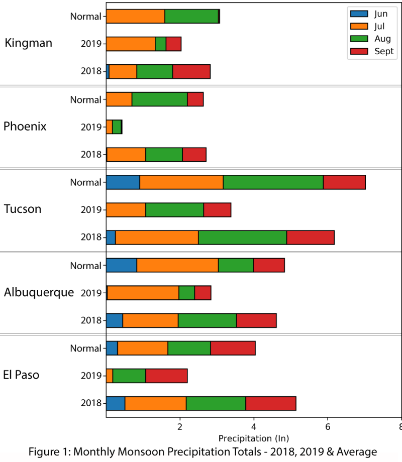
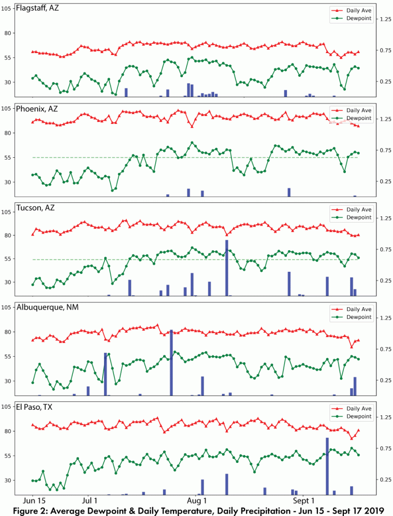
Single weather stations are an imperfect measure of monsoon spatial variability, but they do provide an opportunity to track long term averages compared to the current year. Figure 1 compares 2019 precipitation to date with 2018 and climatology. This reveals 2019 is lagging behind average in terms of precipitation and is also a significant departure from 2018’s widespread activity that continued into September. Daily average and dewpoint temperatures, along with daily and cumulative precipitation illustrate that while increased dewpoint temperatures do not guarantee monsoon precipitation, it is rare to see monsoon precipitation in the absence of these elevated dewpoint temperatures (Fig. 2).
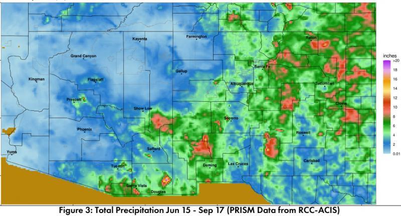
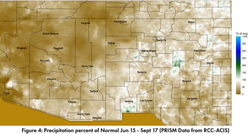
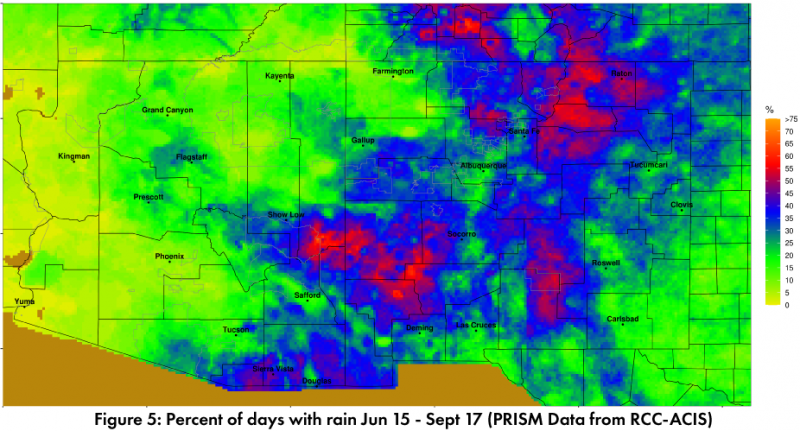
Total monsoon precipitation (Fig. 3) is variable in the Southwest, with much of the region lagging behind average through mid-September (Fig. 4). Percent of days with rain highlight areas with more (or less) regular rainfall events (Fig. 5). 2019 is shaping up to be one of the drier monsoons for much of the region, and some locations may be in the running for driest monsoon on record. A late September tropical storm could boost precipitation totals, but time is quickly running out.
Online Resources
- Figures 1-2 - Climate Assessment for the Southwest - climas.arizona.edu
- Figures 3-5 - Climate Science Applications Program - cals.arizona.edu/climate/misc/SWMonsoonMaps/current/swus_monsoon.html

