CLIMAS Southwest Climate Outlook - Mar 2017 Climate Summary
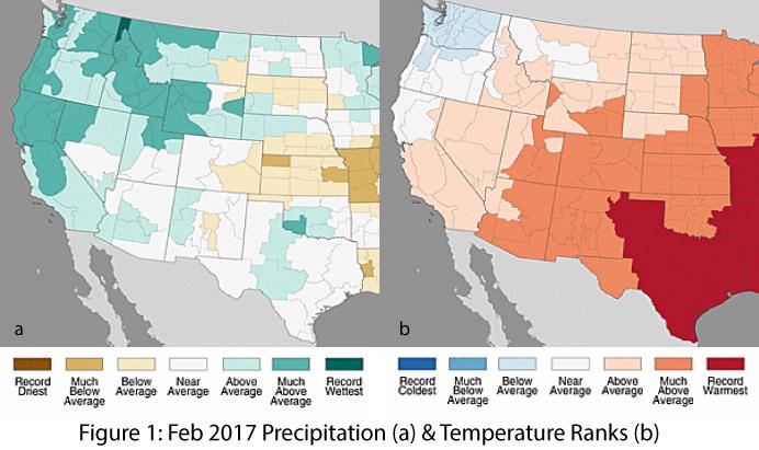
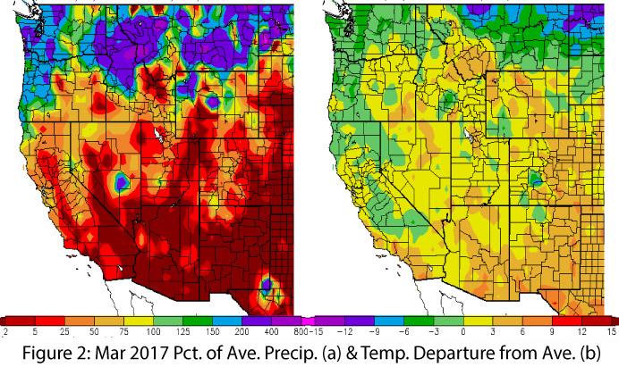
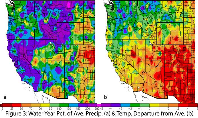
Precipitation & Temperature: February precipitation totals were average to above average in Arizona and ranged from below to above average in New Mexico (Fig. 1a). February temperatures were much-above average across most of region, including record warmest temperatures in eastern New Mexico (Fig. 1b). March precipitation to date has been dry across the Southwest, reversing the wet trends of early winter (Fig. 2a). March temperatures have also been above average across the Southwest (Fig. 2b), including a run of near-record temperatures at the time of this writing. Water-year precipitation and temperature are both above average across much of the Southwest (Fig. 3).
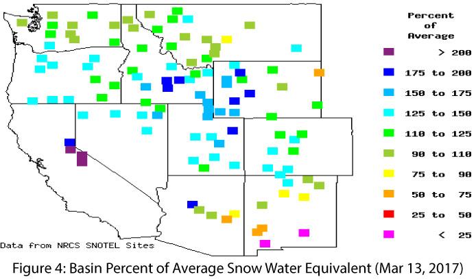
Snowpack & Water Supply: After an impressive run of storms during January and February, activity has tapered and temperatures continue to rise. Snowpack and snow water equivalent (SWE) are both generally well-above average across much of the Intermountain West (Fig. 4). The extent to which persistent above-average temperatures affect water storage dynamics across the West (e.g., rain vs. snow, storage, evaporation, runoff, infiltration, etc.) remains to be seen, although streamflow forecasts remain optimistic for above-average flow. Water managers and drought experts are keeping a close watch on potential changes to streamflow timing given its possible implications for water storage, ecology, and drought.
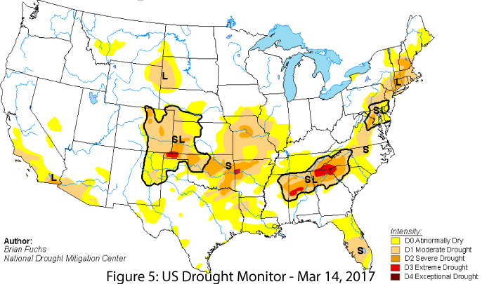
Drought: The storms this winter (and since the water year began on Oct. 1) have resulted in a significant scaling back of drought designations across most of the West. California in particular has seen marked improvement. Southern Arizona (extending into Southern California) and northeastern New Mexico have the remaining pockets of drought in the Southwest, designated as either abnormally dry (D0) or in moderate drought (D1) (Fig. 5). It is important to note that while short-term events have scaled back drought designations, the Southwest has been in drought for most of the last 15 years, so it remains to be seen if this recovery holds and brings long-term improvements to reservoir storage, agricultural and range conditions, wildfire risk, and ecological drought.
Environmental Health & Safety: Fall and winter precipitation led to an explosion of wildflowers in the Southwest, fed by above-average precipitation over much of fall and winter, and boosted by recent above-average temperatures. Pollen levels are also up, and most allergy sufferers will feel the effects from a wide range of pollen sources. A few severe dust events have already resulted in interstate closures, and if warm and dry conditions persist, this could lead to increased dust and particulate matter. The wet fall and winter combined with rapid warming this spring also favors increased production of fine fuels that can carry fire. Current outlooks identify increased fire risk for portions of New Mexico, but fire managers will pay close attention to seasonal weather conditions throughout the region to watch for events or conditions that amplify fire risk.
El Niño Southern Oscillation: With La Niña in the rear-view mirror, forecasts are currently looking towards a possible El Niño event later in 2017. Most forecasts and models call for ENSO-neutral conditions to last through at least spring 2017 (and likely into summer) with a possible return of El Niño conditions in fall 2017 (for more details see ENSO Tracker).
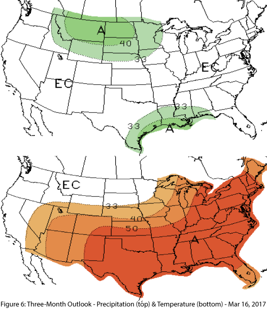
Precipitation & Temperature Forecast: The March 16 NOAA Climate Prediction Center’s outlook for April calls for equal chances of above- or below-average precipitation, and increased chances of above-average temperatures across the region. Likewise, the three-month outlook for April through June calls for equal chances of above- or below-average precipitation (Fig. 6, top) and increased chances of above-average temperatures (Fig. 6, bottom).

