Southwest Climate Outlook November 2019 - Climate Summary
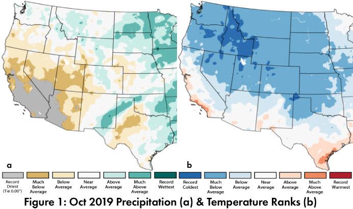
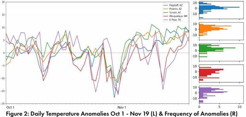
Monthly Precipitation and Temperature: October precipitation in Arizona ranged from below average to record driest, while most of New Mexico was average to above average (Fig. 1a). October temperatures were mostly average to below average in Arizona and New Mexico (Fig. 1b). The daily average temperature anomalies for Oct 1 – Nov 19 (Fig. 2) highlight the fluctuations at select stations around the region including a number of cold spells.
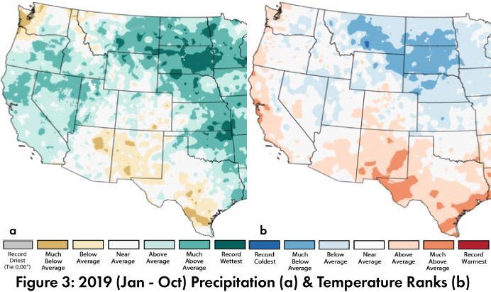
Annual Precipitation and Temperature: Total precipitation for 2019 (Jan-Oct) in Arizona was mostly average to above average, except for the four corners region, while New Mexico was drier with below average conditions across most of the state (Fig. 3a). Mean temperatures in 2019 so far are mostly average to above average in Arizona and above average to much above average in New Mexico (Fig. 3b).
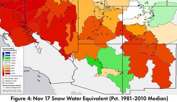
Snowpack & Water Supply: Early season can change quickly, but as of November 18, many Arizona basins are above median snowpack, while New Mexico, Colorado and Utah, are mostly below average (Fig 4). Many of the reservoirs in the region are at or above the values recorded at this time last year, but most are below their long-term average (see Arizona and New Mexico reservoir storage). There have been improvements over the last year, but concerns remain about the recent below average precipitation, along with the accumulated water resource deficits associated with multiple years of drought.
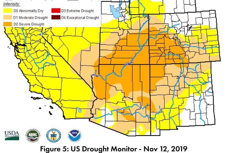
Drought: Drought conditions continue to expand across the Southwest in the Nov. 12 U.S. Drought Monitor (USDM) (Fig. 5). Little precipitation in October, a below average monsoon, and limited incursions of tropical moisture this fall, all contributed to the return of drought designations in much of Arizona and western New Mexico. A large pocket of Severe Drought (D2) is centered on the Arizona/Utah border, but extends well into Arizona, Utah, Colorado, and New Mexico, with Moderate Drought (D1) and Abnormally Dry (D0) making up the characterizations for much of the rest of the Southwest.
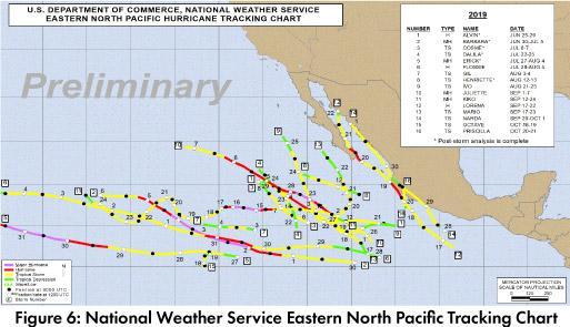
Tropical Storm Activity: The eastern North Pacific hurricane season has been near normal with 19 named storms and 4 major hurricanes (category 4 or above) (Fig. 6). Climatology for the same period is approximately 16.5 named storms and 4.3 major hurricanes. Accumulated Cyclonic Energy in 2019 is at 97.5, with 131 the average total by this date.
ENSO Tracker: Oceanic and atmospheric conditions are generally consistent with an ENSO-neutral outlook for 2019 and into 2020 (see ENSO-tracker for details).
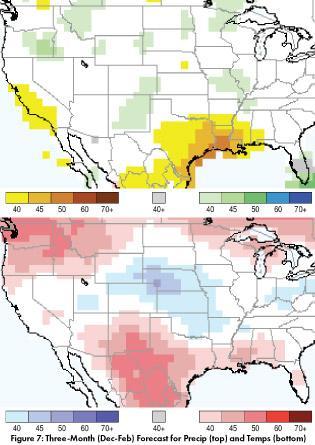
Precipitation and Temperature Forecast: The three-month outlook for November through January calls for increased chances of above-normal precipitation in much of New Mexico, but equal chances of above or below normal precipitation across most of the rest of the Southwest. (Fig. 7, top). The three-month temperature outlook calls for increased chances of above-normal temperatures across most of the U.S. Southwest and northern Mexico (Fig. 7, bottom).
Online Resources
- Figures 1,3 - National Centers for Environmental Information - ncei.noaa.gov
- Figure 2 - Climate Assessment for the Southwest - climas.arizona.edu
- Figure 4 - Natural Resources Conservation Service - nrcs.usda.gov
- Figure 5 - U.S. Drought Monitor - droughtmonitor.unl.edu
- Figure 7 - International Research Institute for Climate and Society - iri.columbia.edu

