What Does Record Arctic Ice Melt Mean for the SW?
Arctic sea ice, much of which melts every summer and refreezes every winter, has overall been declining in extent over the past 30 years—another signal of global warming. In a typical melt season, a little over half of the sea ice melts in the summer. In this season, however, over 75% of Arctic sea ice has melted, setting a new record. On August 26 of this year, Arctic sea ice melted to its lowest extent ever recorded: 1.58 million square miles (the previous record of 1.61 million square miles was set in 2007), according to the National Snow and Ice Data Center.

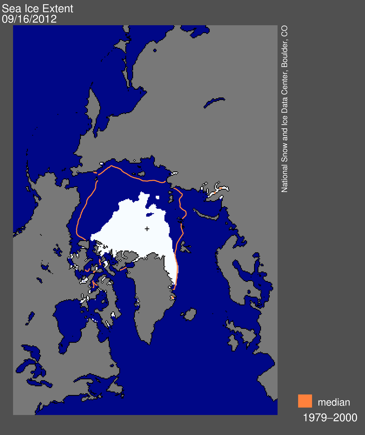
Figure 1: Sea ice extent reached a minimum for this year’s melt season on September 16 (NSIDC).
Since the melt season doesn’t normally end until the second week of September, sea ice continued to melt until September 16, reaching a minimum of 1.32 million square miles (see Figure 1). There are a few ways we can put these numbers into perspective: 1) this year’s minimum is 18% below the previous record minimum in 2007 (an area about the size of Texas); 2) this minimum represents a 49% reduction compared to the 1979 to 2000 average (an area nearly twice the size of Alaska); and 3) the amount of ice that has melted since March of this year is equal to the areas of Alaska and Canada combined (ClimateCentral).
Scientists are astonished by how fast Arctic sea ice is melting. Previous estimates called for the Arctic to be ice-free in the summer in 30-40 years. After this year’s astounding record melt, however, scientists are now thinking the Arctic may be completely ice-free in the summer by the end of the decade!
So what? The Arctic is thousands of miles of away; who cares if it’s melting faster than expected, or at all? In fact, melting sea ice in the Arctic can have profound effects on weather across the mid-latitudes of the Northern Hemisphere, including heavy precipitation in the Northeast U.S. and heat waves in Russia. But what about here in the Southwest? Can we be affected by this system so far away?
The answer is most definitely yes. Conditions in the Arctic influence the jet stream, which, as it winds its way across North America, can sometimes dip far to the south, bringing cold air into the region, as in February 2011 (see previous blog), and winter precipitation (this animation illustrates the jet stream well). However, as the Earth warms, models show the jet stream being pushed northward, away from the Southwest (Yin, 2005). Another study by McAfee and Russell (2008) show that a northward shift in the jet stream would lead to reduced precipitation in the western U.S. during late winter and spring—the time when precipitation is especially important as a source of spring snowmelt, the main water source for millions of people in the region.

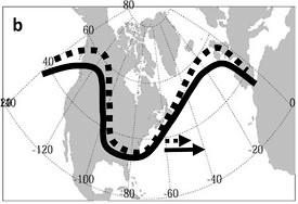
Melting sea ice can change things even further by slowing down the movement of the jet stream across the northern continents, and also increasing its “wiggliness” (see Figure 2; Francis and Vavrus 2012). As the Arctic warms, sea ice melts, resulting in a reduced albedo, or reflectivity of the Earth’s surface. Ice is bright and white and reflects sunlight, whereas ocean water is dark and absorbs sunlight. So as the ice melts, there is more open ocean water to absorb sunlight, warming the region even further. This process is known as a positive feedback, since the initial warming is reinforced by additional warming. Because of this, the Arctic is warming faster than mid-latitudes, creating a temperature gradient that will likely result in a jet stream with increased amplitude, which in turn will slow down its eastward movement.
What this could mean for the Southwest, according to Joellen Russell, a climate modeling professor in the University of Arizona geosciences department, is that on the rare occasions when the jet stream does dip down into the Southwest, it may persist longer. So freezes such as the one in 2011 could last a week instead of four days, compounding the impacts such as frozen pipes, widespread vegetation loss, and ice storms.
These findings on how melting sea ice could affect the jet stream are still rather new, and since conditions in the Arctic are changing so fast, it’s hard to know for sure what the effects here will be. Effects outside of the Southwest, however, are more robust. As the Arctic warms, an increase in water vapor in the region during late fall and winter will provide enhanced moisture sources that will produce heavy winter snowfall in the Northeast and Midwest as well as in Europe during early winter (Liu et al. 2012).
The melting in the Arctic this year is unprecedented. According to Russell, “we did not expect to find ourselves here so fast.” We are in uncharted waters (pun intended), so predicting the effects of melting sea ice on mid-latitude regions is extremely difficult. What makes matters worse is that conditions in the Arctic are changing so fast that once we think we’ve figured out the effects and the mechanisms behind them, they could change again, moving the system into a new phase. But scientists continue to work hard to try and predict these changes as best as they can because, as Russell said, “if we can predict ahead of time these changes, we can be better prepared to adapt.”
