Southwest Climate Outlook January 2017 - Climate Summary
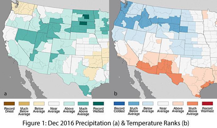
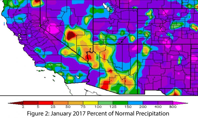
Precipitation & Temperature: December precipitation totals for the past 30 days were above average to much above average in Arizona’s climate divisions and were mostly above average in New Mexico’s climate divisions (Fig. 1a). December temperatures were much above average across most of southern Arizona and southwestern New Mexico, with mostly above-average temperatures across the remainder of the two states (Fig. 1b). A number of storm systems in so far 2017 have brought well above-average moisture to the region, although portions of Arizona have missed out on this precipitation (Fig. 2). January temperatures have been warmer than average across the Southwest and colder than average across the Northwest.
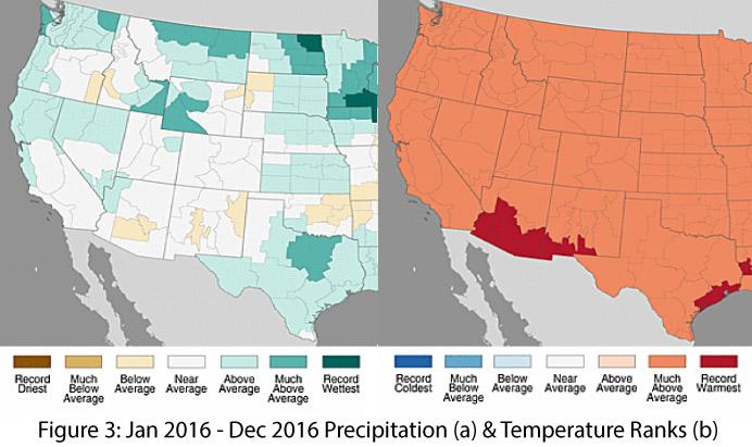
Year in Review: Globally, 2016 was the warmest year on record, and it was the second warmest year on record for the contiguous United States. Regionally, Arizona and New Mexico recorded the second warmest year statewide, with record-warm temperatures in the climate divisions along the U.S./Mexico border (Fig. 3a). Precipitation totals for 2016 were near average for most of Arizona and New Mexico, with below-average precipitation in the central region of both states (Fig. 3b).
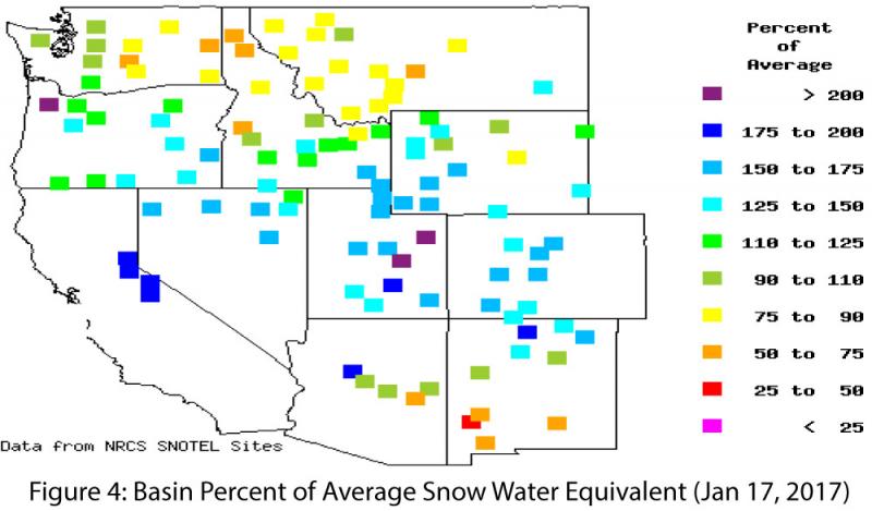
Snowpack & Water Supply: An atmospheric river hammered the West with rain and snow, resulting in flooding at lower elevations and tremendous increases in snowpack across the mountainous portions of northern California and the Intermountain West. Snow water equivalent (SWE) is above average across much of those areas, but it remains to be seen how much above-average temperatures affect the water storage dynamic across the West (e.g., rain vs. snow, storage, evaporation, runoff, infiltration, etc.). SWE remains average to below average across most of Arizona and New Mexico (Fig. 4), especially in the southern half of both states.
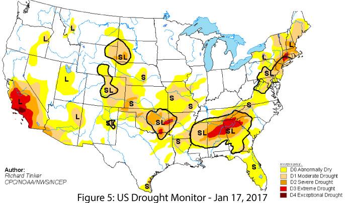
Drought: Long-term drought conditions persist across the Southwest (Fig. 5), although the recent run of moisture in the West has improved drought in regions of northern California and parts of the Intermountain West. According to the Jan. 17 U.S. Drought Monitor, much of Arizona is designated as abnormally dry (D0) or experiencing moderate drought (D1). The far southwestern corner of the state is still designated as experiencing severe drought (D2), reflecting the persistent multi-year drought conditions extending from central and Southern California. Pockets of north-central New Mexico and along the U.S.-Mexico border are still designated as abnormally dry (D0) with a few small remaining areas of moderate drought (D1).
ENSO & La Niña: Borderline weak La Niña conditions are present, but neutral conditions are forecast to return by February and last through at least the first half of 2017. The conditions technically reflect a La Niña event, but in the Southwest, weak La Niña events have been less reliably dry compared to moderate and strong La Niña events. The influence of a weak La Niña might not have even stood out in comparison to normal seasonal variation in the dry Southwest, which already receives limited precipitation in the cool season.
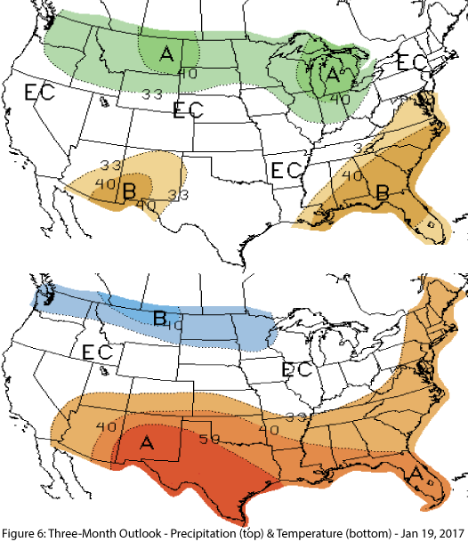
Precipitation & Temperature Forecasts: The Jan. 19 NOAA-Climate Prediction Center’s outlook for February increased chances of below-average precipitation and above-average temperatures across the region. The three-month outlook for February through April calls for increased chances of below-average precipitation for parts of Arizona and most of New Mexico (Fig. 6, top) and increased chances of above-average temperatures for most of the region (Fig. 6, bottom).
Figure Credits:
- Figure 1: National Center for Environmental Information - https://www.ncdc.noaa.gov
- Figure 2: High Plains Regional Climate Center - http://www.hprcc.unl.edu/
- Figure 3: National Center for Environmental Information - https://www.ncdc.noaa.gov
- Figure 4: Western Regional Climate Center - http://www.wrcc.dri.edu/
- Figure 5: U.S. Drought Monitor - http://droughtmonitor.unl.edu/
- Figure 6: NOAA - Climate Prediction Center - http://www.cpc.ncep.noaa.gov/

