ENSO Tracker - Sept 2021
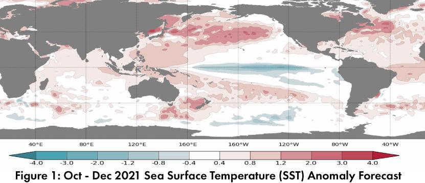
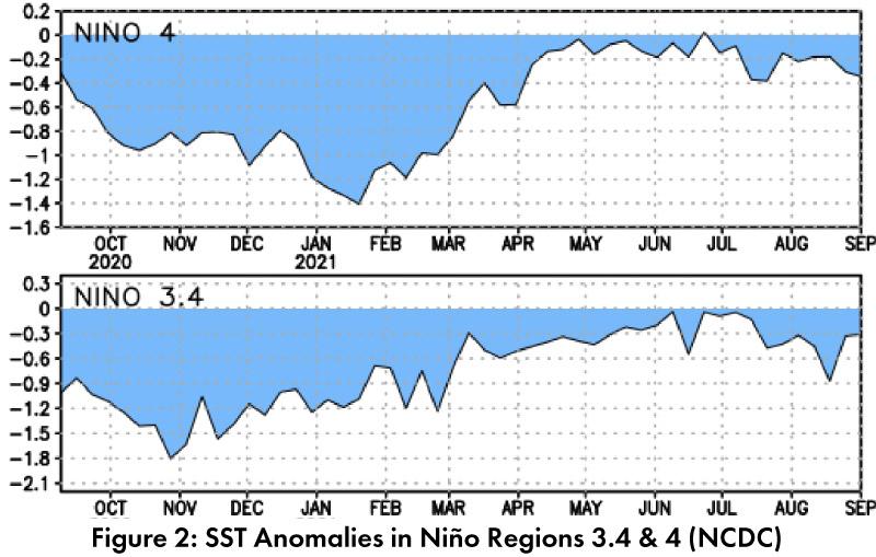
Sea surface temperature (SST) forecasts for Oct-Dec 2021 indicate cooling conditions across the equatorial Pacific (Fig. 1). Current Nino 3.4/4 anomalies are neutral (Fig. 2), and ENSO outlooks note the persistence of neutral conditions in the short term. The outlooks generally see La Niña conditions in place by winter 2021-2022, but there is still some uncertainty about whether those conditions will last long enough to reach the La Niña threshold.
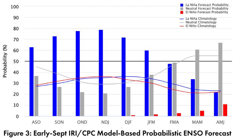
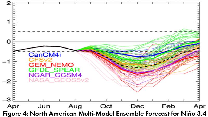
Forecast Roundup: On Sept 9, the NOAA Climate Prediction Center (CPC) ENSO status remained at “La Niña Watch” with an outlook calling for a 70- to 80-percent chance of La Niña during winter 2021-2022. On Sept 9, the International Research Institute (IRI) issued an ENSO Quick Look (Fig. 3), noting “The evolution of most key atmospheric variables is consistent with ENSO-neutral conditions” but that “many models suggest further SST cooling to La Niña levels”. On Sept 10, the Japanese Meteorological Agency (JMA) observed ENSO-neutral conditions continued and called for a 70-percent chance of neutral conditions continuing through autumn. On Sept 14, the Australian Bureau of Meteorology ENSO tracker shifted to La Niña watch status, stating “sea surface temperatures in the central tropical Pacific Ocean have cooled over the past two months, supported by cooler than average waters beneath the surface. Climate models continue this cooling trend over the coming months.” The North American Multi-Model Ensemble (solid and dashed black line, Fig. 4) is at ENSO-neutral levels and is expected to remain neutral through September, but then indicates a quick swing to La Niña conditions in late 2021 and into 2022.
Summary: The seasonal outlooks support plausible scenarios for both ENSO-neutral and La Niña conditions in winter 2021-2022. The forecasts for cooling SSTs in the equatorial region and cooler subsurface temperatures are one reason to lean into a La Niña forecast, but forecasters are still grappling with variability in the models, along with questions about whether La Niña conditions would last long enough to be classified as a La Niña event. La Niña winters are frequently warmer and drier than average in the Southwest, so this forecast is something to watch, given the drought conditions and cumulative precipitation deficits affecting the region.


