Forecast - December | January | February
Temperature
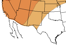 The three-month NOAA temperature outlook (December-February; Figure 5) favors chances of above-average temperatures for all of New Mexico and far West and far North Texas, through February. The outlook favors equal chances for above-, below-, and average temperatures for the rest of Texas. The one-month outlook favors chances for above-average temperatures in almost all of both states for December (figure not shown).
Figure 5 (right): NOAA three-month temperature outlook (December-February). Forecast made on November 15, 2018 by CPC.
The CONAGUA´s Weather Meteorological Service SMN (by acronyms in Spanish) outlook for December, predicts below-average minimum temperatures in Sonora, Nuevo León, Central Coahuila and northern Tamaulipas, and above-average minimum temperatures for Baja California and Chihuahua. For January, SMN predicts below-average anomalies in Tamaulipas, Nuevo León, western Chihuahua and northern Chihuahua, and above-average anomalies for Baja California and some areas of Sonora, western Chihuahua, and Central Coahuila. The rest of the region is expected to experience conditions similar to the average (Figure 6).
Figure 6 (above): Predicted minimum temperature anomalies for northern Mexico in (°C), December 2018 (left) and January 2019 (right). Forecast made on November 1, 2018 by SMN.
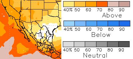
The North American Multi-Model Ensemble (NMME) is an experimental seasonal forecasting system that incorporates forecasts from several different runs of individual models, to create a multi-model ensemble of predictions. This method has been shown to produce better prediction quality, on average, than the ensemble of runs from any single model (CPC). The temperature forecast for December-February favors chances for above-average temperatures for New Mexico, most of Texas, and Chihuahua. The remainder of the region is forecasted to experience average temperatures (Figure 7).
Figure 7 (above): NMME temperature forecast for December-February. Forecast made by CPC.
Precipitation
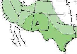 The NOAA three-month precipitation outlook (December-February; Figure 8) shows increased chances of above-average precipitation for all of New Mexico and Texas through February, due to the predicted transition to El Niño during the fall. The one-month outlook (December; figure not shown) favors equal chances for above-, below-, and average precipitation for both states for December.
Figure 8 (right): NOAA three-month precipitation outlook (December-February). Forecast made on November 15, 2018 by CPC.
For December, the SMN precipitation outlook predicts above-average conditions for southern Baja California, northern Sonora, Chihuahua and Tamaulipas, eastern Coahuila, and most of Nuevo León, and below-average precipitation for small areas of Baja California. The precipitation forecast for January shows above-average conditions for Sonora, Chihuahua, western Coahuila, and Central Nuevo León and Tamaulipas, and below-average conditions in most of the Baja California Peninsula. The rest of the region is expected to experience conditions similar to the average (Figure 9).
Figure 9 (above): Predicted precipitation anomalies for northern Mexico (in %), December (left) and January (right). Forecast made on October 1, 2018 by SMN.
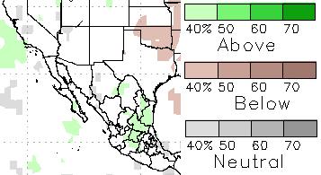
NMME forecasts chances of average precipitation for New Mexico, most of Texas, Chihuahua, and Coahuila, and chances of above-average precipitation for Nuevo León and Tamaulipas, for December-February (Figure 10).
Figure 10 (above): NMME precipitation forecast for December-February. Forecast made by CPC.
Fire
Fire potential is at a minimum during winter months, according to the North American Seasonal Fire Assessment and Outlook. The forecast for December and January indicates below-average fire potential for East Texas, and average fire potential for the remainder of Texas, New Mexico, and all of the northern Mexico states (Figure 11).
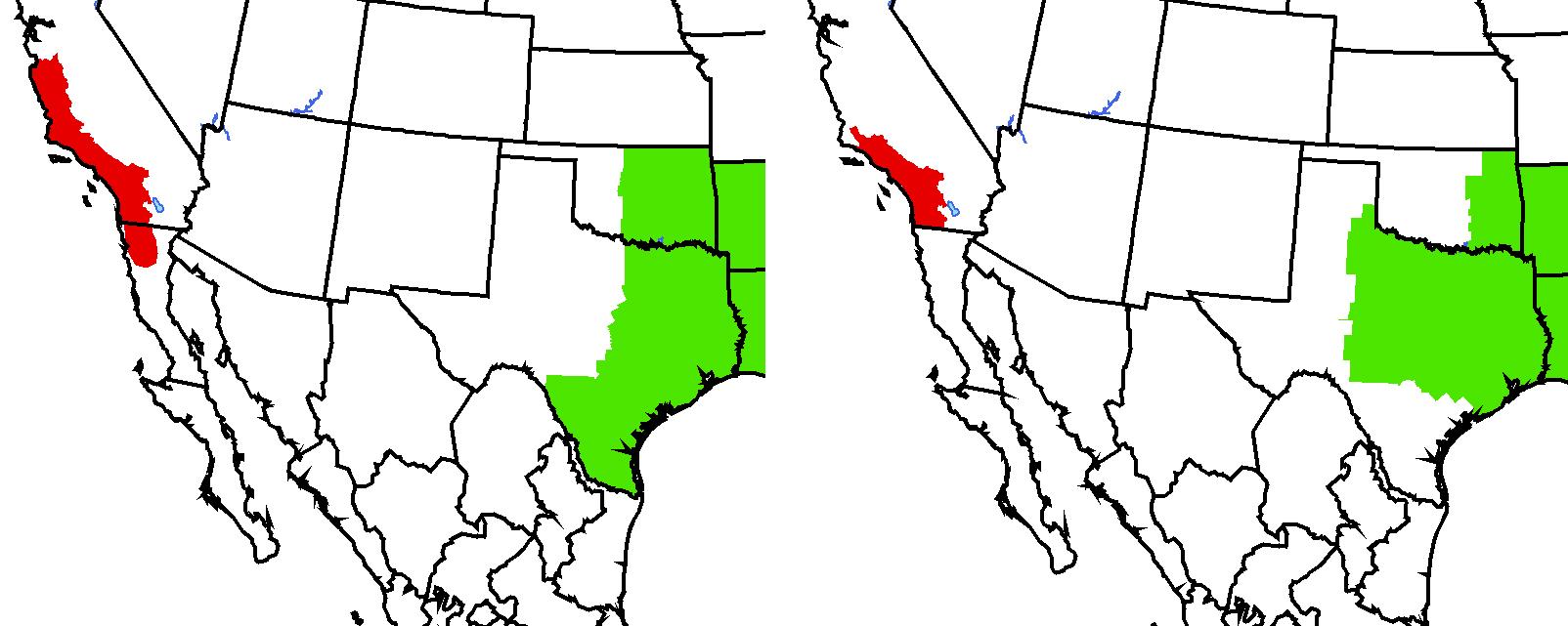 Figure 11 (above): Fire outlook for December (left) and January (right). Red shading indicates conditions that favor increased fire potential. Green shading indicates conditions that favor decreased fire potential. Forecast made on November 14, 2018 from NIFC and SMN.
El Niño-Southern Oscillation
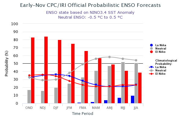
As of mid-November, ENSO-neutral conditions prevailed, but sea-surface temperatures across the tropical Pacific were above average, showing signs of El Niño. The official forecast now predicts an about 80% chance of El Niño forming and continuing through winter, and about a 55-60% chance it will continue into the spring (Figure 12; IRI; NOAA). An El Niño watch is officially in effect. If forecasts are correct, chances of a wet winter in the Southwest U.S. and northern Mexico are likely to increase, as observed in the 3-month CPC precipitation forecasts.
Figure12 (above): Probabilistic ENSO Forecast from IRI.
For more ENSO information:
English: http://iri.columbia.edu/our-expertise/climate/enso/enso-essentials/ y http://www.ncdc.noaa.gov/teleconnections/enso/.
Spanish: http://smn.cna.gob.mx/es/climatologia/diagnostico-climatico/enos y http://www.smn.gov.ar/?mod=biblioteca&id=68


