Monsoon End Q&A
This was originally published Sept 29, 2014, on our blog, Southwestern Oscillations
How Do We Know When the Monsoon is Over?
Across the Southwest United States, the start of the monsoon is pretty easy to recognize once you have experienced it firsthand. In late June or early July, it’s hot and dry one week, and hot and sticky the next, but hopefully raining. The start is relatively clear cut, but calling an end to the monsoon is a bit trickier because there isn’t a rapid and clean transition back to non-monsoon weather conditions in the fall, and breaks in the monsoon can complicate this transition.

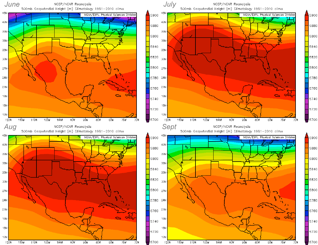
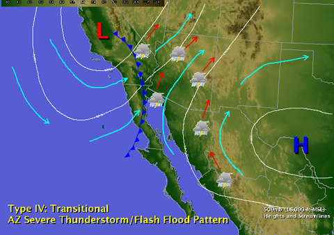
The monsoon circulation pattern and resultant precipitation across the Southwest is largely governed by the position and strength of the subtropical high, also known as the monsoon ridge (Fig. 1). This high pressure system builds north through Mexico into the Southwest from June into July, causing the winds to shift from a dry westerly flow in mid-levels of the atmosphere to a moister, subtropical easterly flow. This shift in wind direction is a key to defining the beginning, as well as the end, of the monsoon. The monsoon ridge typically starts to weaken and retreat through September but can build and subside throughout the month. September is also often when tropical storm moisture can interact with early-season autumn storms moving in from the north Pacific, sparking widespread thunderstorm activity. These transition events are another indication that the monsoon is almost over and that fall weather is on the doorstep (Fig. 2).
